Olešná (Havlíčkův Brod District)
Olešná | |
|---|---|
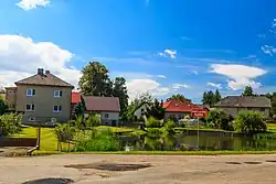 Pond and houses in the centre of Olešná | |
_Flag.jpg) Flag _CoA.png) Coat of arms | |
 Olešná Location in the Czech Republic | |
| Coordinates: 49°40′54″N 15°32′52″E / 49.68167°N 15.54778°E | |
| Country | |
| Region | Vysočina |
| District | Havlíčkův Brod |
| First mentioned | 1591 |
| Area | |
• Total | 6.78 km2 (2.62 sq mi) |
| Elevation | 538 m (1,765 ft) |
| Population (2025-01-01)[1] | |
• Total | 376 |
| • Density | 55/km2 (140/sq mi) |
| Time zone | UTC+1 (CET) |
| • Summer (DST) | UTC+2 (CEST) |
| Postal code | 580 01 |
| Website | www |
Olešná is a municipality and village in Havlíčkův Brod District in the Vysočina Region of the Czech Republic. It has about 400 inhabitants.
Olešná lies approximately 9 kilometres (6 mi) north of Havlíčkův Brod, 32 km (20 mi) north of Jihlava, and 93 km (58 mi) south-east of Prague.
Demographics
| Year | Pop. | ±% |
|---|---|---|
| 1869 | 464 | — |
| 1880 | 511 | +10.1% |
| 1890 | 442 | −13.5% |
| 1900 | 443 | +0.2% |
| 1910 | 425 | −4.1% |
| 1921 | 433 | +1.9% |
| 1930 | 376 | −13.2% |
| 1950 | 343 | −8.8% |
| 1961 | 323 | −5.8% |
| 1970 | 286 | −11.5% |
| 1980 | 303 | +5.9% |
| 1991 | 306 | +1.0% |
| 2001 | 302 | −1.3% |
| 2011 | 326 | +7.9% |
| 2021 | 379 | +16.3% |
| Source: Censuses[2][3] | ||
References
- ^ "Population of Municipalities – 1 January 2025". Czech Statistical Office. 2025-05-16.
- ^ "Historický lexikon obcí České republiky 1869–2011" (in Czech). Czech Statistical Office. 2015-12-21.
- ^ "Population Census 2021: Population by sex". Public Database. Czech Statistical Office. 2021-03-27.
External links
Wikimedia Commons has media related to Olešná (Havlíčkův Brod District).