Saint-Étienne-Estréchoux
Saint-Étienne-Estréchoux | |
|---|---|
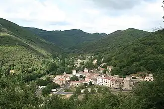 A general view of Saint-Étienne-Estréchoux | |
.svg.png) Coat of arms | |
Location of Saint-Étienne-Estréchoux | |
 Saint-Étienne-Estréchoux  Saint-Étienne-Estréchoux | |
| Coordinates: 43°40′07″N 3°06′16″E / 43.6686°N 3.1044°E | |
| Country | France |
| Region | Occitania |
| Department | Hérault |
| Arrondissement | Béziers |
| Canton | Clermont-l'Hérault |
| Government | |
| • Mayor (2020–2026) | Henri Mathieu[1] |
Area 1 | 3.58 km2 (1.38 sq mi) |
| Population (2022)[2] | 257 |
| • Density | 72/km2 (190/sq mi) |
| Time zone | UTC+01:00 (CET) |
| • Summer (DST) | UTC+02:00 (CEST) |
| INSEE/Postal code | 34252 /34260 |
| Elevation | 255–594 m (837–1,949 ft) (avg. 280 m or 920 ft) |
| 1 French Land Register data, which excludes lakes, ponds, glaciers > 1 km2 (0.386 sq mi or 247 acres) and river estuaries. | |
Saint-Étienne-Estréchoux (Languedocien: Sant Estève d'Estrechós) is a commune in the Hérault department in the Occitanie region in southern France.
Population
| Year | Pop. | ±% p.a. |
|---|---|---|
| 1968 | 502 | — |
| 1975 | 405 | −3.02% |
| 1982 | 354 | −1.90% |
| 1990 | 291 | −2.42% |
| 1999 | 262 | −1.16% |
| 2009 | 245 | −0.67% |
| 2014 | 269 | +1.89% |
| 2020 | 254 | −0.95% |
| Source: INSEE[3] | ||
See also
References
- ^ "Répertoire national des élus: les maires". data.gouv.fr, Plateforme ouverte des données publiques françaises (in French). 9 August 2021.
- ^ "Populations de référence 2022" (in French). The National Institute of Statistics and Economic Studies. 19 December 2024.
- ^ Population en historique depuis 1968, INSEE
Wikimedia Commons has media related to Saint-Étienne-Estréchoux.