Maraussan
Maraussan | |
|---|---|
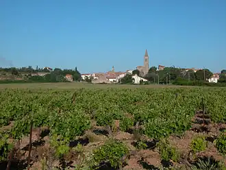 A view of old Maraussan | |
.svg.png) Coat of arms | |
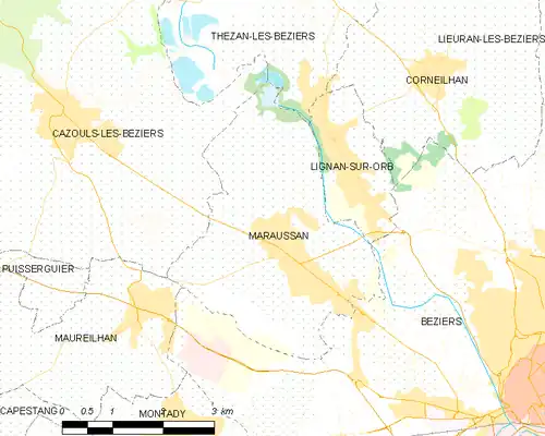
Location of Maraussan | |
 Maraussan  Maraussan | |
| Coordinates: 43°22′03″N 3°09′31″E / 43.3675°N 3.1586°E | |
| Country | France |
| Region | Occitania |
| Department | Hérault |
| Arrondissement | Béziers |
| Canton | Cazouls-lès-Béziers |
| Intercommunality | Domitienne |
| Government | |
| • Mayor (2024–2026) | Marlène Puche[1] |
Area 1 | 12.37 km2 (4.78 sq mi) |
| Population (2022)[2] | 4,693 |
| • Density | 380/km2 (980/sq mi) |
| Time zone | UTC+01:00 (CET) |
| • Summer (DST) | UTC+02:00 (CEST) |
| INSEE/Postal code | 34148 /34370 |
| Elevation | 8–92 m (26–302 ft) (avg. 38 m or 125 ft) |
| 1 French Land Register data, which excludes lakes, ponds, glaciers > 1 km2 (0.386 sq mi or 247 acres) and river estuaries. | |
Maraussan (French pronunciation: [maʁosɑ̃]; Occitan: Marauçan) is a commune in the Hérault department in southern France.
It lies approximately 8 km northwest of Béziers, on route D14 ( Av de Béziers ), a busy route for commuters to Béziers.
Chateau Perdiguier lies just outside the town on the cross road D39 (Route de Tarbaka) leading down to the river Orb.
Population
| Year | Pop. | ±% p.a. |
|---|---|---|
| 1968 | 1,655 | — |
| 1975 | 2,088 | +3.38% |
| 1982 | 2,154 | +0.45% |
| 1990 | 2,336 | +1.02% |
| 1999 | 2,782 | +1.96% |
| 2007 | 3,320 | +2.23% |
| 2012 | 3,976 | +3.67% |
| 2017 | 4,414 | +2.11% |
| Source: INSEE[3] | ||
See also
References
- ^ "Répertoire national des élus: les maires" (in French). data.gouv.fr, Plateforme ouverte des données publiques françaises. 16 April 2024.
- ^ "Populations de référence 2022" (in French). The National Institute of Statistics and Economic Studies. 19 December 2024.
- ^ Population en historique depuis 1968, INSEE
Wikimedia Commons has media related to Maraussan.