Saint-Étienne-à-Arnes
Saint-Étienne-à-Arnes | |
|---|---|
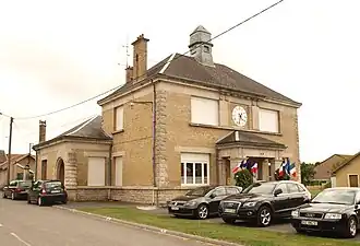 The town hall in Saint-Étienne-à-Arnes | |
 Coat of arms | |
Location of Saint-Étienne-à-Arnes | |
 Saint-Étienne-à-Arnes  Saint-Étienne-à-Arnes | |
| Coordinates: 49°18′39″N 4°29′39″E / 49.3108°N 4.4942°E | |
| Country | France |
| Region | Grand Est |
| Department | Ardennes |
| Arrondissement | Vouziers |
| Canton | Attigny |
| Intercommunality | Argonne Ardennaise |
| Government | |
| • Mayor (2020–2026) | Elise Roussy[1] |
Area 1 | 29.56 km2 (11.41 sq mi) |
| Population (2022)[2] | 245 |
| • Density | 8.3/km2 (21/sq mi) |
| Time zone | UTC+01:00 (CET) |
| • Summer (DST) | UTC+02:00 (CEST) |
| INSEE/Postal code | 08379 /08310 |
| Elevation | 114–208 m (374–682 ft) (avg. 115 m or 377 ft) |
| 1 French Land Register data, which excludes lakes, ponds, glaciers > 1 km2 (0.386 sq mi or 247 acres) and river estuaries. | |
Saint-Étienne-à-Arnes is a commune in the Ardennes department and Grand Est region of north-eastern France.
Population
| Year | Pop. | ±% p.a. |
|---|---|---|
| 1968 | 237 | — |
| 1975 | 227 | −0.61% |
| 1982 | 202 | −1.65% |
| 1990 | 198 | −0.25% |
| 1999 | 166 | −1.94% |
| 2009 | 214 | +2.57% |
| 2014 | 241 | +2.40% |
| 2020 | 243 | +0.14% |
| Source: INSEE[3] | ||
See also
References
- ^ "Répertoire national des élus: les maires". data.gouv.fr, Plateforme ouverte des données publiques françaises (in French). 9 August 2021.
- ^ "Populations de référence 2022" (in French). The National Institute of Statistics and Economic Studies. 19 December 2024.
- ^ Population en historique depuis 1968, INSEE
Wikimedia Commons has media related to Saint-Étienne-à-Arnes.