Restigné
Restigné | |
|---|---|
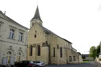 The church of Saint-Martin, in Restigné | |
Location of Restigné | |
 Restigné 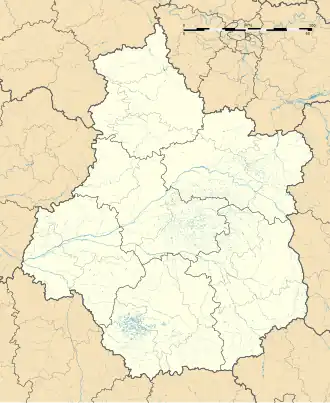 Restigné | |
| Coordinates: 47°16′56″N 0°13′45″E / 47.2822°N 0.2292°E | |
| Country | France |
| Region | Centre-Val de Loire |
| Department | Indre-et-Loire |
| Arrondissement | Chinon |
| Canton | Langeais |
| Government | |
| • Mayor (2020–2026) | Christine Hascoët[1] |
Area 1 | 21.31 km2 (8.23 sq mi) |
| Population (2022)[2] | 1,121 |
| • Density | 53/km2 (140/sq mi) |
| Time zone | UTC+01:00 (CET) |
| • Summer (DST) | UTC+02:00 (CEST) |
| INSEE/Postal code | 37193 /37140 |
| Elevation | 30–114 m (98–374 ft) |
| 1 French Land Register data, which excludes lakes, ponds, glaciers > 1 km2 (0.386 sq mi or 247 acres) and river estuaries. | |
Restigné (French pronunciation: [ʁɛstiɲe]) is a commune in the Indre-et-Loire department in central France.
Population
| Year | Pop. | ±% p.a. |
|---|---|---|
| 1968 | 1,302 | — |
| 1975 | 1,198 | −1.18% |
| 1982 | 1,210 | +0.14% |
| 1990 | 1,187 | −0.24% |
| 1999 | 1,225 | +0.35% |
| 2007 | 1,173 | −0.54% |
| 2012 | 1,192 | +0.32% |
| 2017 | 1,226 | +0.56% |
| Source: INSEE[3] | ||
See also
References
- ^ "Répertoire national des élus: les maires". data.gouv.fr, Plateforme ouverte des données publiques françaises (in French). 9 August 2021.
- ^ "Populations de référence 2022" (in French). The National Institute of Statistics and Economic Studies. 19 December 2024.
- ^ Population en historique depuis 1968, INSEE
Wikimedia Commons has media related to Restigné.