Marignier
Marignier | |
|---|---|
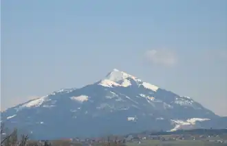 Le Môle seen from Marignier | |
.svg.png) Coat of arms | |
Location of Marignier | |
 Marignier  Marignier | |
| Coordinates: 46°05′28″N 6°30′00″E / 46.0911°N 6.5°E | |
| Country | France |
| Region | Auvergne-Rhône-Alpes |
| Department | Haute-Savoie |
| Arrondissement | Bonneville |
| Canton | Bonneville |
| Government | |
| • Mayor (2020–2026) | Christophe Pery[1] |
Area 1 | 19.97 km2 (7.71 sq mi) |
| Population (2022)[2] | 6,432 |
| • Density | 320/km2 (830/sq mi) |
| Time zone | UTC+01:00 (CET) |
| • Summer (DST) | UTC+02:00 (CEST) |
| INSEE/Postal code | 74164 /74970 |
| Elevation | 453–1,860 m (1,486–6,102 ft) |
| 1 French Land Register data, which excludes lakes, ponds, glaciers > 1 km2 (0.386 sq mi or 247 acres) and river estuaries. | |
Marignier (French pronunciation: [maʁiɲe]) is a commune in the Haute-Savoie department in the Auvergne-Rhône-Alpes region in south-eastern France.
Population
| Year | Pop. | ±% p.a. |
|---|---|---|
| 1968 | 3,070 | — |
| 1975 | 3,451 | +1.69% |
| 1982 | 3,679 | +0.92% |
| 1990 | 4,322 | +2.03% |
| 1999 | 5,323 | +2.34% |
| 2007 | 6,114 | +1.75% |
| 2012 | 6,357 | +0.78% |
| 2017 | 6,445 | +0.28% |
| Source: INSEE[3] | ||
Transport
The commune has a railway station, Marignier, on the La Roche-sur-Foron–Saint-Gervais-les-Bains-Le Fayet line.
See also
References
- ^ "Répertoire national des élus: les maires" (in French). data.gouv.fr, Plateforme ouverte des données publiques françaises. 13 September 2022.
- ^ "Populations de référence 2022" (in French). The National Institute of Statistics and Economic Studies. 19 December 2024.
- ^ Population en historique depuis 1968, INSEE
Wikimedia Commons has media related to Marignier.