Habère-Lullin
Habère-Lullin | |
|---|---|
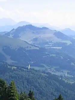 The Pointe de Miribel, the highest point in Habère-Lullin, seen from Mont Forchat | |
Location of Habère-Lullin | |
 Habère-Lullin  Habère-Lullin | |
| Coordinates: 46°14′04″N 6°27′11″E / 46.2344°N 6.4531°E | |
| Country | France |
| Region | Auvergne-Rhône-Alpes |
| Department | Haute-Savoie |
| Arrondissement | Thonon-les-Bains |
| Canton | Sciez |
| Intercommunality | CC Vallée Verte |
| Government | |
| • Mayor (2020–2026) | Laurent Desbiolles[1] |
Area 1 | 8.86 km2 (3.42 sq mi) |
| Population (2022)[2] | 1,091 |
| • Density | 120/km2 (320/sq mi) |
| Time zone | UTC+01:00 (CET) |
| • Summer (DST) | UTC+02:00 (CEST) |
| INSEE/Postal code | 74139 /74420 |
| Elevation | 790–1,597 m (2,592–5,240 ft) |
| 1 French Land Register data, which excludes lakes, ponds, glaciers > 1 km2 (0.386 sq mi or 247 acres) and river estuaries. | |
Habère-Lullin (French pronunciation: [abɛʁ lylɛ̃]; Arpitan: Âbèro d’Avâl) is a commune in the Haute-Savoie department in the Auvergne-Rhône-Alpes region in south-eastern France. It lies on the river Menoge, in the Vallée Verte.
Population
| Year | Pop. | ±% p.a. |
|---|---|---|
| 1968 | 374 | — |
| 1975 | 370 | −0.15% |
| 1982 | 395 | +0.94% |
| 1990 | 514 | +3.35% |
| 1999 | 634 | +2.36% |
| 2007 | 795 | +2.87% |
| 2012 | 883 | +2.12% |
| 2017 | 1,010 | +2.72% |
| Source: INSEE[3] | ||
See also
References
- ^ "Répertoire national des élus: les maires". data.gouv.fr, Plateforme ouverte des données publiques françaises (in French). 2 December 2020.
- ^ "Populations de référence 2022" (in French). The National Institute of Statistics and Economic Studies. 19 December 2024.
- ^ Population en historique depuis 1968, INSEE
Wikimedia Commons has media related to Habère-Lullin.