Madison Township, Washington County, Indiana
Madison Township | |
|---|---|
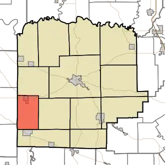
 Countryside in the township | |
 Location in Washington County | |
| Coordinates: 38°31′15″N 86°16′36″W / 38.52083°N 86.27667°W | |
| Country | United States |
| State | Indiana |
| County | Washington |
| Government | |
| • Type | Indiana township |
| Area | |
• Total | 26.09 sq mi (67.6 km2) |
| • Land | 26.04 sq mi (67.4 km2) |
| • Water | 0.05 sq mi (0.1 km2) 0.19% |
| Elevation | 748 ft (228 m) |
| Population (2020) | |
• Total | 628 |
| • Density | 24/sq mi (9.3/km2) |
| ZIP codes | 47108, 47125, 47167, 47452 |
| GNIS feature ID | 0453600 |
Madison Township is one of thirteen townships in Washington County, Indiana, United States. As of the 2020 census, its population was 628 and it contained 256 housing units.[1]
| Census | Pop. | Note | %± |
|---|---|---|---|
| 1890 | 949 | — | |
| 1900 | 911 | −4.0% | |
| 1910 | 749 | −17.8% | |
| 1920 | 664 | −11.3% | |
| 1930 | 541 | −18.5% | |
| 1940 | 660 | 22.0% | |
| 1950 | 575 | −12.9% | |
| 1960 | 516 | −10.3% | |
| 1970 | 513 | −0.6% | |
| 1980 | 555 | 8.2% | |
| 1990 | 607 | 9.4% | |
| 2000 | 602 | −0.8% | |
| 2010 | 705 | 17.1% | |
| 2020 | 628 | −10.9% | |
| Source: US Decennial Census[2] | |||
Geography
According to the 2010 census, the township has a total area of 26.09 square miles (67.6 km2), of which 26.04 square miles (67.4 km2) (or 99.81%) is land and 0.05 square miles (0.13 km2) (or 0.19%) is water.[3]
Cities, towns, villages
Adjacent townships
- Vernon Township (north)
- Howard Township (east)
- Posey Township (southeast)
- Southeast Township, Orange County (southwest)
- Stampers Creek Township, Orange County (west)
Cemeteries
The township contains these four cemeteries: Livonia, Hardin, Providence and Sinking Spring.
School districts
- West Washington School Corporation
Political districts
- Indiana's 9th congressional district
- State House District 73
- State Senate District 44
References
- United States Census Bureau 2007 TIGER/Line Shapefiles
- United States Board on Geographic Names (GNIS)
- IndianaMap
- ^ "Explore Census Data". data.census.gov. Retrieved April 11, 2024.
- ^ "Township Census Counts: STATS Indiana".
- ^ "Population, Housing Units, Area, and Density: 2010 - County -- County Subdivision and Place -- 2010 Census Summary File 1". United States Census. Archived from the original on February 12, 2020. Retrieved May 10, 2013.
External links
Municipalities and communities of Washington County, Indiana, United States | ||
|---|---|---|
| City | 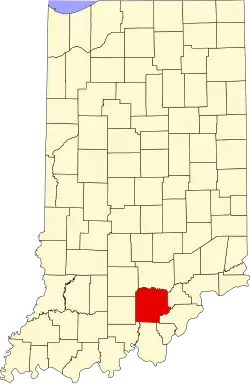 | |
| Towns | ||
| Townships | ||
| CDPs | ||
| Other communities |
| |