Jackson Township, Washington County, Indiana
Jackson Township | |
|---|---|
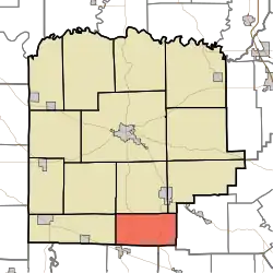 Location in Washington County | |
| Coordinates: 38°26′23″N 86°03′18″W / 38.43972°N 86.05500°W | |
| Country | United States |
| State | Indiana |
| County | Washington |
| Government | |
| • Type | Indiana township |
| Area | |
• Total | 25.48 sq mi (66.0 km2) |
| • Land | 25.39 sq mi (65.8 km2) |
| • Water | 0.09 sq mi (0.2 km2) 0.35% |
| Elevation | 751 ft (229 m) |
| Population (2020) | |
• Total | 2,019 |
| • Density | 79/sq mi (31/km2) |
| ZIP codes | 47106, 47164, 47165 |
| GNIS feature ID | 0453472 |
Jackson Township is one of thirteen townships in Washington County, Indiana, United States. As of the 2020 census, its population was 2,019 and it contained 832 housing units.[1]
| Census | Pop. | Note | %± |
|---|---|---|---|
| 1890 | 766 | — | |
| 1900 | 779 | 1.7% | |
| 1910 | 707 | −9.2% | |
| 1920 | 678 | −4.1% | |
| 1930 | 631 | −6.9% | |
| 1940 | 663 | 5.1% | |
| 1950 | 613 | −7.5% | |
| 1960 | 588 | −4.1% | |
| 1970 | 602 | 2.4% | |
| 1980 | 972 | 61.5% | |
| 1990 | 1,247 | 28.3% | |
| 2000 | 2,037 | 63.4% | |
| 2010 | 2,116 | 3.9% | |
| 2020 | 2,019 | −4.6% | |
| Source: US Decennial Census[2] | |||
Geography
According to the 2010 census, the township has a total area of 25.48 square miles (66.0 km2), of which 25.39 square miles (65.8 km2) (or 99.65%) is land and 0.09 square miles (0.23 km2) (or 0.35%) is water.[3]
Unincorporated towns
(This list is based on USGS data and may include former settlements.)
Adjacent townships
- Pierce Township (north)
- Polk Township (northeast)
- Wood Township, Clark County (east)
- Greenville Township, Floyd County (southeast)
- Morgan Township, Harrison County (southwest)
- Posey Township (west)
- Howard Township (northwest)
Cemeteries
The township contains four cemeteries: Goss, Hiestand, Martinsburg and Rickerd.
Lakes
- Palmyra Lake
School districts
- East Washington School Corporation
Political districts
- Indiana's 9th congressional district
- State House District 73
- State Senate District 47
References
- United States Census Bureau 2007 TIGER/Line Shapefiles
- United States Board on Geographic Names (GNIS)
- IndianaMap
- ^ "Explore Census Data". data.census.gov. Retrieved April 10, 2024.
- ^ "Township Census Counts: STATS Indiana".
- ^ "Population, Housing Units, Area, and Density: 2010 - County -- County Subdivision and Place -- 2010 Census Summary File 1". United States Census. Retrieved May 10, 2013.
External links
Municipalities and communities of Washington County, Indiana, United States | ||
|---|---|---|
| City | 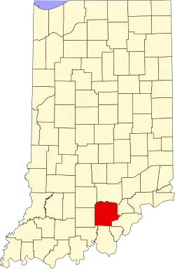 | |
| Towns | ||
| Townships | ||
| CDPs | ||
| Other communities |
| |