Le Monastère
Le Monastère | |
|---|---|
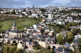 A general view of Le Monastère | |
Location of Le Monastère | |
 Le Monastère  Le Monastère | |
| Coordinates: 44°20′37″N 2°34′45″E / 44.3436°N 2.5792°E | |
| Country | France |
| Region | Occitania |
| Department | Aveyron |
| Arrondissement | Rodez |
| Canton | Rodez-2 |
| Intercommunality | Rodez Agglomération |
| Government | |
| • Mayor (2020–2026) | Jacques Montoya[1] |
Area 1 | 6.73 km2 (2.60 sq mi) |
| Population (2022)[2] | 2,301 |
| • Density | 340/km2 (890/sq mi) |
| Time zone | UTC+01:00 (CET) |
| • Summer (DST) | UTC+02:00 (CEST) |
| INSEE/Postal code | 12146 /12000 |
| Elevation | 519–648 m (1,703–2,126 ft) (avg. 558 m or 1,831 ft) |
| 1 French Land Register data, which excludes lakes, ponds, glaciers > 1 km2 (0.386 sq mi or 247 acres) and river estuaries. | |
Le Monastère (French pronunciation: [lə mɔnastɛʁ]; Occitan: Lo Monestire) is a commune in the Aveyron department in southern France.
Population
| Year | Pop. | ±% p.a. |
|---|---|---|
| 1968 | 937 | — |
| 1975 | 1,201 | +3.61% |
| 1982 | 1,256 | +0.64% |
| 1990 | 1,579 | +2.90% |
| 1999 | 1,809 | +1.52% |
| 2007 | 2,095 | +1.85% |
| 2012 | 2,104 | +0.09% |
| 2017 | 2,283 | +1.65% |
| Source: INSEE[3] | ||
See also
References
- ^ "Répertoire national des élus: les maires". data.gouv.fr, Plateforme ouverte des données publiques françaises (in French). 9 August 2021.
- ^ "Populations de référence 2022" (in French). The National Institute of Statistics and Economic Studies. 19 December 2024.
- ^ Population en historique depuis 1968, INSEE
Wikimedia Commons has media related to Le Monastère.