Krajníčko
Krajníčko | |
|---|---|
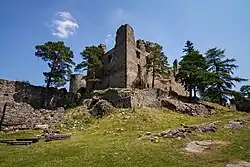 Helfenburk Castle | |
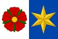 Flag 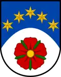 Coat of arms | |
 Krajníčko Location in the Czech Republic | |
| Coordinates: 49°8′51″N 14°1′44″E / 49.14750°N 14.02889°E | |
| Country | |
| Region | South Bohemian |
| District | Strakonice |
| First mentioned | 1334 |
| Area | |
• Total | 7.52 km2 (2.90 sq mi) |
| Elevation | 524 m (1,719 ft) |
| Population (2025-01-01)[1] | |
• Total | 96 |
| • Density | 13/km2 (33/sq mi) |
| Time zone | UTC+1 (CET) |
| • Summer (DST) | UTC+2 (CEST) |
| Postal code | 387 73 |
| Website | www |
Krajníčko is a municipality and village in Strakonice District in the South Bohemian Region of the Czech Republic. It has about 100 inhabitants.
Krajníčko lies approximately 16 kilometres (10 mi) south-east of Strakonice, 39 km (24 mi) north-west of České Budějovice, and 109 km (68 mi) south of Prague.
Demographics
| Year | Pop. | ±% |
|---|---|---|
| 1869 | 241 | — |
| 1880 | 286 | +18.7% |
| 1890 | 275 | −3.8% |
| 1900 | 321 | +16.7% |
| 1910 | 314 | −2.2% |
| 1921 | 327 | +4.1% |
| 1930 | 289 | −11.6% |
| 1950 | 221 | −23.5% |
| 1961 | 202 | −8.6% |
| 1970 | 153 | −24.3% |
| 1980 | 118 | −22.9% |
| 1991 | 105 | −11.0% |
| 2001 | 94 | −10.5% |
| 2011 | 91 | −3.2% |
| 2021 | 95 | +4.4% |
| Source: Censuses[2][3] | ||
References
- ^ "Population of Municipalities – 1 January 2025". Czech Statistical Office. 2025-05-16.
- ^ "Historický lexikon obcí České republiky 1869–2011" (in Czech). Czech Statistical Office. 2015-12-21.
- ^ "Population Census 2021: Population by sex". Public Database. Czech Statistical Office. 2021-03-27.
External links
Wikimedia Commons has media related to Krajníčko.