Třešovice
Třešovice | |
|---|---|
.jpg) Homestead No. 13 | |
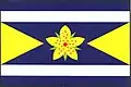 Flag 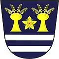 Coat of arms | |
 Třešovice Location in the Czech Republic | |
| Coordinates: 49°12′41″N 13°58′53″E / 49.21139°N 13.98139°E | |
| Country | |
| Region | South Bohemian |
| District | Strakonice |
| First mentioned | 1303 |
| Area | |
• Total | 4.30 km2 (1.66 sq mi) |
| Elevation | 459 m (1,506 ft) |
| Population (2025-01-01)[1] | |
• Total | 67 |
| • Density | 16/km2 (40/sq mi) |
| Time zone | UTC+1 (CET) |
| • Summer (DST) | UTC+2 (CEST) |
| Postal code | 386 01 |
| Website | www |
Třešovice is a municipality and village in Strakonice District in the South Bohemian Region of the Czech Republic. It has about 70 inhabitants.
Demographics
| Year | Pop. | ±% |
|---|---|---|
| 1869 | 224 | — |
| 1880 | 218 | −2.7% |
| 1890 | 233 | +6.9% |
| 1900 | 218 | −6.4% |
| 1910 | 221 | +1.4% |
| 1921 | 220 | −0.5% |
| 1930 | 203 | −7.7% |
| 1950 | 166 | −18.2% |
| 1961 | 125 | −24.7% |
| 1970 | 111 | −11.2% |
| 1980 | 83 | −25.2% |
| 1991 | 78 | −6.0% |
| 2001 | 80 | +2.6% |
| 2011 | 76 | −5.0% |
| 2021 | 66 | −13.2% |
| Source: Censuses[2][3] | ||
References
- ^ "Population of Municipalities – 1 January 2025". Czech Statistical Office. 2025-05-16.
- ^ "Historický lexikon obcí České republiky 1869–2011" (in Czech). Czech Statistical Office. 2015-12-21.
- ^ "Population Census 2021: Population by sex". Public Database. Czech Statistical Office. 2021-03-27.
External links
Wikimedia Commons has media related to Třešovice.