Forcelles-sous-Gugney
Forcelles-sous-Gugney | |
|---|---|
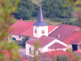 The church in Forcelles-sous-Gugney | |
 Coat of arms | |
Location of Forcelles-sous-Gugney | |
 Forcelles-sous-Gugney  Forcelles-sous-Gugney | |
| Coordinates: 48°23′54″N 6°04′44″E / 48.3983°N 6.0789°E | |
| Country | France |
| Region | Grand Est |
| Department | Meurthe-et-Moselle |
| Arrondissement | Nancy |
| Canton | Meine au Saintois |
| Intercommunality | Pays du Saintois |
| Government | |
| • Mayor (2020–2026) | Mathieu Saint Mihiel[1] |
Area 1 | 5.37 km2 (2.07 sq mi) |
| Population (2022)[2] | 89 |
| • Density | 17/km2 (43/sq mi) |
| Time zone | UTC+01:00 (CET) |
| • Summer (DST) | UTC+02:00 (CEST) |
| INSEE/Postal code | 54204 /54930 |
| Elevation | 292–451 m (958–1,480 ft) (avg. 307 m or 1,007 ft) |
| 1 French Land Register data, which excludes lakes, ponds, glaciers > 1 km2 (0.386 sq mi or 247 acres) and river estuaries. | |
Forcelles-sous-Gugney (French pronunciation: [fɔʁsɛl su ɡyɲɛ], literally Forcelles under Gugney) is a commune in the Meurthe-et-Moselle department in north-eastern France.
See also
References
- ^ "Répertoire national des élus: les maires" (in French). data.gouv.fr, Plateforme ouverte des données publiques françaises. 13 September 2022.
- ^ "Populations de référence 2022" (in French). The National Institute of Statistics and Economic Studies. 19 December 2024.
Wikimedia Commons has media related to Forcelles-sous-Gugney.