Corbeny
Corbény | |
|---|---|
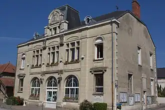 The town hall of Corbeny | |
.svg.png) Coat of arms | |
Location of Corbény | |
 Corbény  Corbény | |
| Coordinates: 49°27′46″N 3°49′28″E / 49.4628°N 3.8244°E | |
| Country | France |
| Region | Hauts-de-France |
| Department | Aisne |
| Arrondissement | Laon |
| Canton | Villeneuve-sur-Aisne |
| Intercommunality | Chemin des Dames |
| Government | |
| • Mayor (2020–2026) | Dany Vandois[1] |
Area 1 | 15.23 km2 (5.88 sq mi) |
| Population (2022)[2] | 849 |
| • Density | 56/km2 (140/sq mi) |
| Time zone | UTC+01:00 (CET) |
| • Summer (DST) | UTC+02:00 (CEST) |
| INSEE/Postal code | 02215 /02820 |
| Elevation | 64–134 m (210–440 ft) (avg. 80 m or 260 ft) |
| Website | www.corbeny.fr |
| 1 French Land Register data, which excludes lakes, ponds, glaciers > 1 km2 (0.386 sq mi or 247 acres) and river estuaries. | |
Corbeny (French pronunciation: [kɔʁbəni]; in the Middle Ages: Corbunei) is a commune in the Aisne department in Hauts-de-France in northern France.
Geography
The river Ailette flows south through the northwestern part of the commune.
Population
| Year | Pop. | ±% |
|---|---|---|
| 1962 | 540 | — |
| 1968 | 517 | −4.3% |
| 1975 | 495 | −4.3% |
| 1982 | 578 | +16.8% |
| 1990 | 591 | +2.2% |
| 1999 | 633 | +7.1% |
| 2008 | 710 | +12.2% |
| 2012 | 748 | +5.4% |
See also
References
- ^ "Répertoire national des élus: les maires" (in French). data.gouv.fr, Plateforme ouverte des données publiques françaises. 13 September 2022.
- ^ "Populations de référence 2022" (in French). The National Institute of Statistics and Economic Studies. 19 December 2024.
Wikimedia Commons has media related to Corbeny.