Bruyères-sur-Fère
Bruyères-sur-Fère | |
|---|---|
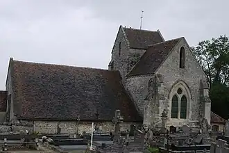 The church of Bruyères-sur-Fère | |
Location of Bruyères-sur-Fère | |
 Bruyères-sur-Fère  Bruyères-sur-Fère | |
| Coordinates: 49°11′25″N 3°26′36″E / 49.1903°N 3.4433°E | |
| Country | France |
| Region | Hauts-de-France |
| Department | Aisne |
| Arrondissement | Château-Thierry |
| Canton | Fère-en-Tardenois |
| Intercommunality | CA Région de Château-Thierry |
| Government | |
| • Mayor (2020–2026) | Fabien Fraeyman[1] |
Area 1 | 9.05 km2 (3.49 sq mi) |
| Population (2022)[2] | 195 |
| • Density | 22/km2 (56/sq mi) |
| Time zone | UTC+01:00 (CET) |
| • Summer (DST) | UTC+02:00 (CEST) |
| INSEE/Postal code | 02127 /02130 |
| Elevation | 91–169 m (299–554 ft) (avg. 136 m or 446 ft) |
| 1 French Land Register data, which excludes lakes, ponds, glaciers > 1 km2 (0.386 sq mi or 247 acres) and river estuaries. | |
Bruyères-sur-Fère (French pronunciation: [bʁɥijɛʁ syʁ fɛʁ], literally Bruyères on Fère) is a commune in the department of Aisne in Hauts-de-France in northern France.
Population
| Year | Pop. | ±% |
|---|---|---|
| 1962 | 249 | — |
| 1968 | 233 | −6.4% |
| 1975 | 224 | −3.9% |
| 1982 | 184 | −17.9% |
| 1990 | 213 | +15.8% |
| 1999 | 217 | +1.9% |
| 2008 | 208 | −4.1% |
See also
References
- ^ "Répertoire national des élus: les maires". data.gouv.fr, Plateforme ouverte des données publiques françaises (in French). 2 December 2020.
- ^ "Populations de référence 2022" (in French). The National Institute of Statistics and Economic Studies. 19 December 2024.
Wikimedia Commons has media related to Bruyères-sur-Fère.