Bouglainval
Bouglainval | |
|---|---|
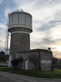 The water tower in Bouglainval | |
Location of Bouglainval | |
 Bouglainval 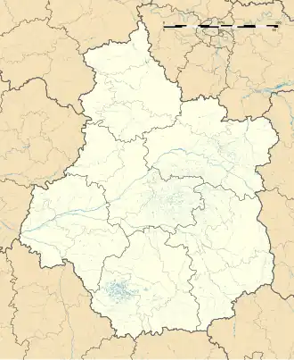 Bouglainval | |
| Coordinates: 48°33′54″N 1°30′33″E / 48.565°N 1.5092°E | |
| Country | France |
| Region | Centre-Val de Loire |
| Department | Eure-et-Loir |
| Arrondissement | Chartres |
| Canton | Épernon |
| Intercommunality | CA Chartres Métropole |
| Government | |
| • Mayor (2020–2026) | Philippe Baeteman[1] |
Area 1 | 14.2 km2 (5.5 sq mi) |
| Population (2022)[2] | 737 |
| • Density | 52/km2 (130/sq mi) |
| Time zone | UTC+01:00 (CET) |
| • Summer (DST) | UTC+02:00 (CEST) |
| INSEE/Postal code | 28052 /28130 |
| Elevation | 122–171 m (400–561 ft) |
| 1 French Land Register data, which excludes lakes, ponds, glaciers > 1 km2 (0.386 sq mi or 247 acres) and river estuaries. | |
Bouglainval (French pronunciation: [buɡlɛ̃val]) is a commune in the Eure-et-Loir department in northern France.
Population
| Year | Pop. | ±% |
|---|---|---|
| 1962 | 252 | — |
| 1968 | 264 | +4.8% |
| 1975 | 329 | +24.6% |
| 1982 | 565 | +71.7% |
| 1990 | 753 | +33.3% |
| 1999 | 801 | +6.4% |
| 2008 | 738 | −7.9% |
See also
References
- ^ "Répertoire national des élus: les maires". data.gouv.fr, Plateforme ouverte des données publiques françaises (in French). 2 December 2020.
- ^ "Populations de référence 2022" (in French). The National Institute of Statistics and Economic Studies. 19 December 2024.
Wikimedia Commons has media related to Bouglainval.