Uzunköprü District
Uzunköprü District | |
|---|---|
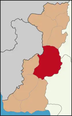 Map showing Uzunköprü District in Edirne Province | |
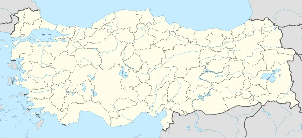 Uzunköprü District Location in Turkey  Uzunköprü District Uzunköprü District (Marmara) | |
| Coordinates: 41°16′N 26°41′E / 41.267°N 26.683°E | |
| Country | Turkey |
| Province | Edirne |
| Seat | Uzunköprü |
| Government | |
| • Kaymakam | Ömer Sevgili |
Area | 1,185 km2 (458 sq mi) |
| Population (2022) | 59,351 |
| • Density | 50/km2 (130/sq mi) |
| Time zone | UTC+3 (TRT) |
| Website | www |
Uzunköprü District is a district of the Edirne Province of Turkey. Its seat is the town of Uzunköprü.[1] Its area is 1,185 km2,[2] and its population is 59,351 (2022).[3]
Composition
There are two municipalities in Uzunköprü District:[1][4]
There are 53 villages in Uzunköprü District:[5]
- Alıç
- Altınyazı
- Aslıhan
- Balaban
- Balabankoru
- Başağıl
- Bayramlı
- Beykonak
- Bıldır
- Çakmak
- Çalıköy
- Çavuşlu
- Çiftlikköy
- Çobanpınar
- Danişment
- Değirmenci
- Dereköy
- Elmalı
- Eskiköy
- Gazihalil
- Gazimehmet
- Gemici
- Hamidiye
- Hamitli
- Harmanlı
- Hasanpınar
- Kadıköy
- Karabürçek
- Karapınar
- Karayayla
- Kavacık
- Kavakayazma
- Kiremitçisalih
- Kırkkavak
- Kırköy
- Kurdu
- Kurtbey
- Kurttepe
- Maksutlu
- Malkoç
- Meşeli
- Muhacırkadı
- Ömerbey
- Saçlımüsellim
- Salarlı
- Sazlımalkoç
- Sığırcılı
- Sipahi
- Süleymaniye
- Sultanşah
- Türkobası
- Turnacı
- Yağmurca
References
- ^ a b İlçe Belediyesi, Turkey Civil Administration Departments Inventory. Retrieved 1 March 2023.
- ^ "İl ve İlçe Yüz ölçümleri". General Directorate of Mapping. Retrieved 1 March 2023.
- ^ "Address-based population registration system (ADNKS) results dated 31 December 2022, Favorite Reports" (XLS). TÜİK. Retrieved 13 March 2023.
- ^ Belde Belediyesi, Turkey Civil Administration Departments Inventory. Retrieved 1 March 2023.
- ^ Köy, Turkey Civil Administration Departments Inventory. Retrieved 1 March 2023.
Uzunköprü District in Edirne Province of Turkey | |||||||||||||||||||||||||||
|---|---|---|---|---|---|---|---|---|---|---|---|---|---|---|---|---|---|---|---|---|---|---|---|---|---|---|---|
| Districts |  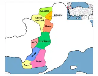 | ||||||||||||||||||||||||||
|
Metropolitan municipalities are bolded. | |||||||||||||||||||||||||||