Uhersko
Uhersko | |
|---|---|
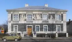 Municipal office and post office | |
.png) Flag _CoA_CZ.png) Coat of arms | |
 Uhersko Location in the Czech Republic | |
| Coordinates: 49°59′33″N 16°1′4″E / 49.99250°N 16.01778°E | |
| Country | |
| Region | Pardubice |
| District | Pardubice |
| First mentioned | 1308 |
| Area | |
• Total | 3.67 km2 (1.42 sq mi) |
| Elevation | 252 m (827 ft) |
| Population (2025-01-01)[1] | |
• Total | 412 |
| • Density | 110/km2 (290/sq mi) |
| Time zone | UTC+1 (CET) |
| • Summer (DST) | UTC+2 (CEST) |
| Postal code | 533 73 |
| Website | www |
Uhersko a municipality and village in Pardubice District in the Pardubice Region of the Czech Republic. It has about 400 inhabitants.
History
The first written mention of Uhersko is from 1308.[2]
Demographics
| Year | Pop. | ±% |
|---|---|---|
| 1869 | 453 | — |
| 1880 | 439 | −3.1% |
| 1890 | 470 | +7.1% |
| 1900 | 430 | −8.5% |
| 1910 | 421 | −2.1% |
| 1921 | 414 | −1.7% |
| 1930 | 419 | +1.2% |
| 1950 | 330 | −21.2% |
| 1961 | 363 | +10.0% |
| 1970 | 340 | −6.3% |
| 1980 | 276 | −18.8% |
| 1991 | 251 | −9.1% |
| 2001 | 266 | +6.0% |
| 2011 | 272 | +2.3% |
| 2021 | 296 | +8.8% |
| Source: Censuses[3][4] | ||
Sights
_04.JPG)
The main landmark of Uhersko is the Church of the Assumption of the Virgin Mary. It was built in the Baroque style in 1704.[2]
References
- ^ "Population of Municipalities – 1 January 2025". Czech Statistical Office. 2025-05-16.
- ^ a b "Historie" (in Czech). Obec Uhersko. Retrieved 2022-07-11.
- ^ "Historický lexikon obcí České republiky 1869–2011" (in Czech). Czech Statistical Office. 2015-12-21.
- ^ "Population Census 2021: Population by sex". Public Database. Czech Statistical Office. 2021-03-27.
External links
Wikimedia Commons has media related to Uhersko.