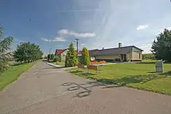
Holotín
Holotín | |
|---|---|
 Municipal office | |
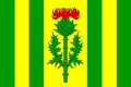 Flag 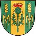 Coat of arms | |
 Holotín Location in the Czech Republic | |
| Coordinates: 50°56′45″N 15°34′49″E / 50.94583°N 15.58028°E | |
| Country | |
| Region | Pardubice |
| District | Pardubice |
| First mentioned | 1405 |
| Area | |
• Total | 2.77 km2 (1.07 sq mi) |
| Elevation | 355 m (1,165 ft) |
| Population (2025-01-01)[1] | |
• Total | 59 |
| • Density | 21/km2 (55/sq mi) |
| Time zone | UTC+1 (CET) |
| • Summer (DST) | UTC+2 (CEST) |
| Postal code | 535 01 |
| Website | www |
Holotín is a municipality and village in Pardubice District in the Pardubice Region of the Czech Republic. It has about 60 inhabitants.
Demographics
| Year | Pop. | ±% |
|---|---|---|
| 1869 | 134 | — |
| 1880 | 144 | +7.5% |
| 1890 | 154 | +6.9% |
| 1900 | 149 | −3.2% |
| 1910 | 170 | +14.1% |
| 1921 | 146 | −14.1% |
| 1930 | 142 | −2.7% |
| 1950 | 122 | −14.1% |
| 1961 | 107 | −12.3% |
| 1970 | 98 | −8.4% |
| 1980 | 76 | −22.4% |
| 1991 | 55 | −27.6% |
| 2001 | 38 | −30.9% |
| 2011 | 45 | +18.4% |
| 2021 | 62 | +37.8% |
| Source: Censuses[2][3] | ||
References
- ^ "Population of Municipalities – 1 January 2025". Czech Statistical Office. 2025-05-16.
- ^ "Historický lexikon obcí České republiky 1869–2011" (in Czech). Czech Statistical Office. 2015-12-21.
- ^ "Population Census 2021: Population by sex". Public Database. Czech Statistical Office. 2021-03-27.
External links
Wikimedia Commons has media related to Holotín.