Třeštice
Třeštice | |
|---|---|
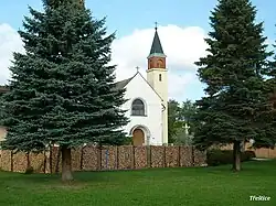 Chapel of Saint Anthony of Padua | |
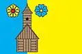 Flag 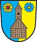 Coat of arms | |
 Třeštice Location in the Czech Republic | |
| Coordinates: 49°14′44″N 15°27′12″E / 49.24556°N 15.45333°E | |
| Country | |
| Region | Vysočina |
| District | Jihlava |
| First mentioned | 1341 |
| Area | |
• Total | 7.02 km2 (2.71 sq mi) |
| Elevation | 582 m (1,909 ft) |
| Population (2025-01-01)[1] | |
• Total | 162 |
| • Density | 23/km2 (60/sq mi) |
| Time zone | UTC+1 (CET) |
| • Summer (DST) | UTC+2 (CEST) |
| Postal code | 588 56 |
| Website | www |
Třeštice (Czech pronunciation: [ˈtr̝̊ɛʃcɪtsɛ]) is a municipality and village in Jihlava District in the Vysočina Region of the Czech Republic. It has about 200 inhabitants.
Třeštice lies approximately 19 kilometres (12 mi) south-west of Jihlava and 120 km (75 mi) south-east of Prague.
Demographics
| Year | Pop. | ±% |
|---|---|---|
| 1869 | 282 | — |
| 1880 | 285 | +1.1% |
| 1890 | 296 | +3.9% |
| 1900 | 260 | −12.2% |
| 1910 | 292 | +12.3% |
| 1921 | 297 | +1.7% |
| 1930 | 262 | −11.8% |
| 1950 | 164 | −37.4% |
| 1961 | 163 | −0.6% |
| 1970 | 150 | −8.0% |
| 1980 | 126 | −16.0% |
| 1991 | 112 | −11.1% |
| 2001 | 114 | +1.8% |
| 2011 | 112 | −1.8% |
| 2021 | 156 | +39.3% |
| Source: Censuses[2][3] | ||
References
- ^ "Population of Municipalities – 1 January 2025". Czech Statistical Office. 2025-05-16.
- ^ "Historický lexikon obcí České republiky 1869–2011" (in Czech). Czech Statistical Office. 2015-12-21.
- ^ "Population Census 2021: Population by sex". Public Database. Czech Statistical Office. 2021-03-27.
External links
Wikimedia Commons has media related to Třeštice.