Cerekvička-Rosice
Cerekvička-Rosice | |
|---|---|
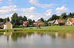 Centre of Rosice | |
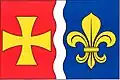 Flag 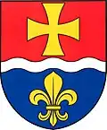 Coat of arms | |
 Cerekvička-Rosice Location in the Czech Republic | |
| Coordinates: 49°20′4″N 15°35′14″E / 49.33444°N 15.58722°E | |
| Country | |
| Region | Vysočina |
| District | Jihlava |
| First mentioned | 1358 |
| Area | |
• Total | 9.01 km2 (3.48 sq mi) |
| Elevation | 550 m (1,800 ft) |
| Population (2025-01-01)[1] | |
• Total | 241 |
| • Density | 27/km2 (69/sq mi) |
| Time zone | UTC+1 (CET) |
| • Summer (DST) | UTC+2 (CEST) |
| Postal code | 588 33 |
| Website | www |
Cerekvička-Rosice (Czech pronunciation: [ˈtsɛrɛkvitʃka ˈrosɪtsɛ]) is a municipality in Jihlava District in the Vysočina Region of the Czech Republic. It has about 200 inhabitants.
Cerekvička-Rosice lies approximately 8 kilometres (5 mi) south of Jihlava and 120 km (75 mi) south-east of Prague.
Administrative division
Cerekvička-Rosice consists of two municipal parts (in brackets population according to the 2021 census):[2]
- Cerekvička (122)
- Rosice (74)
Demographics
| Year | Pop. | ±% |
|---|---|---|
| 1869 | 340 | — |
| 1880 | 326 | −4.1% |
| 1890 | 346 | +6.1% |
| 1900 | 331 | −4.3% |
| 1910 | 324 | −2.1% |
| 1921 | 298 | −8.0% |
| 1930 | 305 | +2.3% |
| 1950 | 222 | −27.2% |
| 1961 | 207 | −6.8% |
| 1970 | 153 | −26.1% |
| 1980 | 123 | −19.6% |
| 1991 | 120 | −2.4% |
| 2001 | 131 | +9.2% |
| 2011 | 131 | +0.0% |
| 2021 | 196 | +49.6% |
| Source: Censuses[3][4] | ||
References
- ^ "Population of Municipalities – 1 January 2025". Czech Statistical Office. 2025-05-16.
- ^ "Public Census 2021 – basic data". Public Database (in Czech). Czech Statistical Office. 2022.
- ^ "Historický lexikon obcí České republiky 1869–2011" (in Czech). Czech Statistical Office. 2015-12-21.
- ^ "Population Census 2021: Population by sex". Public Database. Czech Statistical Office. 2021-03-27.
External links
Wikimedia Commons has media related to Cerekvička-Rosice.