Salt Creek Commons, Indiana
Salt Creek Commons, Indiana | |
|---|---|
 Location of Salt Creek Commons in Porter County, Indiana. | |
| Coordinates: 41°30′40″N 87°08′28″W / 41.51111°N 87.14111°W | |
| Country | United States |
| State | Indiana |
| Counties | Porter |
| Township | Union |
| Area | |
• Total | 0.37 sq mi (0.96 km2) |
| • Land | 0.37 sq mi (0.96 km2) |
| • Water | 0.00 sq mi (0.00 km2) |
| Elevation | 666 ft (203 m) |
| Population (2020) | |
• Total | 1,979 |
| • Density | 5,319.89/sq mi (2,052.66/km2) |
| Time zone | UTC-6 (Central (CST)) |
| • Summer (DST) | UTC-5 (CDT) |
| ZIP code | 46385 |
| Area code | 219 |
| FIPS code | 18-67608[3] |
| GNIS feature ID | 2629777[2] |
Salt Creek Commons is a census-designated place (CDP) in Union Township, Porter County, in the U.S. state of Indiana.[2] The population was 2,117 at the 2010 census.[4]
Geography
Salt Creek Commons is located 2 miles (3 km) east of Wheeler and 6 miles (10 km) northwest of Valparaiso, the county seat. The CDP encompasses a housing development to the west of Salt Creek, a north-flowing stream which runs to the Little Calumet River.
According to the United States Census Bureau, the CDP has a total area of 0.39 square miles (1.0 km2), all land.[4]
Demographics
| Census | Pop. | Note | %± |
|---|---|---|---|
| 2020 | 1,979 | — | |
| U.S. Decennial Census[5] | |||
References
- ^ "2020 U.S. Gazetteer Files". United States Census Bureau. Retrieved March 16, 2022.
- ^ a b c U.S. Geological Survey Geographic Names Information System: Salt Creek Commons, Indiana
- ^ "U.S. Census website". United States Census Bureau. Retrieved January 31, 2008.
- ^ a b "Geographic Identifiers: 2010 Demographic Profile Data (DP-1): Salt Creek Commons CDP, Indiana". U.S. Census Bureau, American Factfinder. Archived from the original on February 10, 2020. Retrieved March 25, 2013.
- ^ "Census of Population and Housing". Census.gov. Retrieved June 4, 2016.
Municipalities and communities of Porter County, Indiana, United States | ||
|---|---|---|
| Cities | 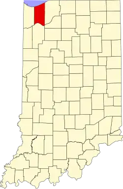 | |
| Towns | ||
| Townships | ||
| CDPs | ||
| Other communities | ||
| Ghost towns | ||
| Footnotes | ‡This populated place also has portions in an adjacent county or counties | |