Salačova Lhota
Salačova Lhota | |
|---|---|
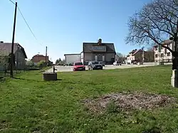 Centre of Salačova Lhota | |
 Flag  Coat of arms | |
 Salačova Lhota Location in the Czech Republic | |
| Coordinates: 49°31′27″N 14°58′49″E / 49.52417°N 14.98028°E | |
| Country | |
| Region | Vysočina |
| District | Pelhřimov |
| First mentioned | 1407 |
| Area | |
• Total | 5.98 km2 (2.31 sq mi) |
| Elevation | 573 m (1,880 ft) |
| Population (2025-01-01)[1] | |
• Total | 131 |
| • Density | 22/km2 (57/sq mi) |
| Time zone | UTC+1 (CET) |
| • Summer (DST) | UTC+2 (CEST) |
| Postal code | 395 01 |
| Website | www |
Salačova Lhota is a municipality and village in Pelhřimov District in the Vysočina Region of the Czech Republic. It has about 100 inhabitants.
Salačova Lhota lies approximately 21 kilometres (13 mi) north-west of Pelhřimov, 47 km (29 mi) west of Jihlava, and 75 km (47 mi) south-east of Prague.
Administrative division
Salačova Lhota consists of three municipal parts (in brackets population according to the 2021 census):[2]
- Salačova Lhota (99)
- Malá Černá (10)
- Velká Černá (18)
Demographics
| Year | Pop. | ±% |
|---|---|---|
| 1869 | 387 | — |
| 1880 | 414 | +7.0% |
| 1890 | 370 | −10.6% |
| 1900 | 341 | −7.8% |
| 1910 | 351 | +2.9% |
| 1921 | 339 | −3.4% |
| 1930 | 256 | −24.5% |
| 1950 | 226 | −11.7% |
| 1961 | 236 | +4.4% |
| 1970 | 201 | −14.8% |
| 1980 | 194 | −3.5% |
| 1991 | 146 | −24.7% |
| 2001 | 140 | −4.1% |
| 2011 | 132 | −5.7% |
| 2021 | 127 | −3.8% |
| Source: Censuses[3][4] | ||
References
- ^ "Population of Municipalities – 1 January 2025". Czech Statistical Office. 2025-05-16.
- ^ "Public Census 2021 – basic data". Public Database (in Czech). Czech Statistical Office. 2022.
- ^ "Historický lexikon obcí České republiky 1869–2011" (in Czech). Czech Statistical Office. 2015-12-21.
- ^ "Population Census 2021: Population by sex". Public Database. Czech Statistical Office. 2021-03-27.
External links
Wikimedia Commons has media related to Salačova Lhota.