Čáslavsko
Čáslavsko | |
|---|---|
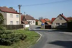 Main street | |
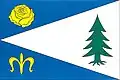 Flag  Coat of arms | |
 Čáslavsko Location in the Czech Republic | |
| Coordinates: 49°35′33″N 15°0′10″E / 49.59250°N 15.00278°E | |
| Country | |
| Region | Vysočina |
| District | Pelhřimov |
| First mentioned | 1545 |
| Area | |
• Total | 9.57 km2 (3.69 sq mi) |
| Elevation | 578 m (1,896 ft) |
| Population (2025-01-01)[1] | |
• Total | 107 |
| • Density | 11/km2 (29/sq mi) |
| Time zone | UTC+1 (CET) |
| • Summer (DST) | UTC+2 (CEST) |
| Postal code | 395 01 |
| Website | www |
Čáslavsko (German: Tschaslawsko) is a municipality and village in Pelhřimov District in the Vysočina Region of the Czech Republic. It has about 100 inhabitants.
Čáslavsko lies approximately 24 kilometres (15 mi) north-west of Pelhřimov, 48 km (30 mi) north-west of Jihlava, and 69 km (43 mi) south-east of Prague.
Administrative division
Čáslavsko consists of five municipal parts (in brackets population according to the 2021 census):[2]
- Čáslavsko (50)
- Jelenov (6)
- Kopaniny (21)
- Skočidolovice (10)
- Štědrovice (21)
Demographics
| Year | Pop. | ±% |
|---|---|---|
| 1869 | 804 | — |
| 1880 | 731 | −9.1% |
| 1890 | 746 | +2.1% |
| 1900 | 669 | −10.3% |
| 1910 | 659 | −1.5% |
| 1921 | 630 | −4.4% |
| 1930 | 559 | −11.3% |
| 1950 | 408 | −27.0% |
| 1961 | 391 | −4.2% |
| 1970 | 361 | −7.7% |
| 1980 | 261 | −27.7% |
| 1991 | 173 | −33.7% |
| 2001 | 116 | −32.9% |
| 2011 | 107 | −7.8% |
| 2021 | 108 | +0.9% |
| Source: Censuses[3][4] | ||
References
- ^ "Population of Municipalities – 1 January 2025". Czech Statistical Office. 2025-05-16.
- ^ "Public Census 2021 – basic data". Public Database (in Czech). Czech Statistical Office. 2022.
- ^ "Historický lexikon obcí České republiky 1869–2011" (in Czech). Czech Statistical Office. 2015-12-21.
- ^ "Population Census 2021: Population by sex". Public Database. Czech Statistical Office. 2021-03-27.
External links
Wikimedia Commons has media related to Čáslavsko.