Sainte-Colombe-en-Auxois
Sainte-Colombe-en-Auxois | |
|---|---|
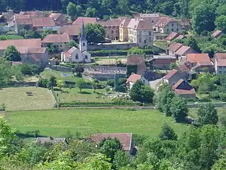 A general view of Sainte-Colombe-en-Auxois | |
Location of Sainte-Colombe-en-Auxois | |
 Sainte-Colombe-en-Auxois 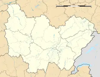 Sainte-Colombe-en-Auxois | |
| Coordinates: 47°25′40″N 4°27′31″E / 47.4278°N 4.4586°E | |
| Country | France |
| Region | Bourgogne-Franche-Comté |
| Department | Côte-d'Or |
| Arrondissement | Montbard |
| Canton | Semur-en-Auxois |
| Government | |
| • Mayor (2020–2026) | Pierre Faure-Sternad[1] |
Area 1 | 6.29 km2 (2.43 sq mi) |
| Population (2022)[2] | 52 |
| • Density | 8.3/km2 (21/sq mi) |
| Time zone | UTC+01:00 (CET) |
| • Summer (DST) | UTC+02:00 (CEST) |
| INSEE/Postal code | 21544 /21350 |
| Elevation | 333–498 m (1,093–1,634 ft) (avg. 405 m or 1,329 ft) |
| 1 French Land Register data, which excludes lakes, ponds, glaciers > 1 km2 (0.386 sq mi or 247 acres) and river estuaries. | |
Sainte-Colombe-en-Auxois (French pronunciation: [sɛ̃t kɔlɔ̃b ɑ̃.n‿o(k)swa] ⓘ, lit. 'Sainte Colombe in Auxois'; before 2014: Sainte-Colombe)[3] is a commune in the Côte-d'Or department in eastern France.
Population
| Year | Pop. | ±% |
|---|---|---|
| 1962 | 48 | — |
| 1968 | 56 | +16.7% |
| 1975 | 44 | −21.4% |
| 1982 | 45 | +2.3% |
| 1990 | 53 | +17.8% |
| 1999 | 59 | +11.3% |
| 2008 | 69 | +16.9% |
See also
References
- ^ "Répertoire national des élus: les maires" (in French). data.gouv.fr, Plateforme ouverte des données publiques françaises. 13 September 2022.
- ^ "Populations de référence 2022" (in French). The National Institute of Statistics and Economic Studies. 19 December 2024.
- ^ Décret n° 2014-1447 3 December 2014 (in French)
Wikimedia Commons has media related to Sainte-Colombe-en-Auxois.