Riacho das Almas
Riacho das Almas | |
|---|---|
 City Forum | |
 Riacho das Almas Riacho das Almas located in Brazil Map | |
| Coordinates: 8°8′S 35°52′W / 8.133°S 35.867°W | |
| Country | |
| State | Pernambuco |
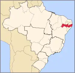
| Region | Agreste |
| Area | |
• Total | 313.99 km2 (121.23 sq mi) |
| Elevation | 407 m (1,335 ft) |
| Population (2020 [1]) | |
• Total | 20,646 |
| Time zone | UTC−3 (BRT) |

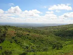
Riacho das Almas (population 20,646) is a city in northeastern Brazil, in the State of Pernambuco. It lies in the mesoregion of Agreste of Pernambuco and has 313.99 sq/km of total area.
Geography
- State - Pernambuco
- Region - Agreste of Pernambuco
- Boundaries - Surubim and Frei Miguelinho (N); Caruaru (S and W); Bezerros and Cumaru (E).
- Area - 313.99 km2
- Elevation - 407 m
- Hydrography - Capibaribe and Ipojuca rivers
- Vegetation - Caatinga hipoxerófila
- Annual average temperature - 23.6 c
- Distance to Recife - 152 km
Economy
The main economic activities in Riacho das Almas are the textile industry and agribusiness, especially farming of cattle, goats, sheep, pigs, chickens; and plantations of pineapples and manioc.
Economic Indicators
| Population[2] | GDP x(1000 R$).[3] | GDP pc (R$) | PE |
|---|---|---|---|
| 18.930 | 62.157 | 3.402 | 0.10% |
Economy by Sector (2006)
| Primary sector | Secondary sector | Service sector |
|---|---|---|
| 12.00% | 9.46% | 78.54% |
Health Indicators
| HDI (2000)[4] | Hospitals (2007) | Hospitals beds (2007) | Children's Mortality every 1000 (2005) |
|---|---|---|---|
| 0.609 | 1 | 29 | 10.3 |
See also
References
- ^ IBGE 2020
- ^ IBGE Population 2009 Riacho das Almas, page 34
- ^ Riacho das Almas 2007 GDP IBGE page 31 Archived 2016-03-04 at the Wayback Machine
- ^ PE State site - City by city profile
Wikimedia Commons has media related to Riacho das Almas.
Capital: Recife | ||||||||||||||
| Mesoregion Agreste Pernambucano |
|  | ||||||||||||
| Mesoregion Mata Pernambucana |
| |||||||||||||
| Mesoregion Metropolitana de Recife |
| |||||||||||||
| Mesoregion Sao Francisco Pernambucano |
| |||||||||||||
| Mesoregion Sertão Pernambucano |
| |||||||||||||