Račice nad Trotinou
Račice nad Trotinou | |
|---|---|
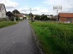 Entrance to Račice nad Trotinou | |
 Flag  Coat of arms | |
 Račice nad Trotinou Location in the Czech Republic | |
| Coordinates: 50°18′57″N 15°47′46″E / 50.31583°N 15.79611°E | |
| Country | |
| Region | Hradec Králové |
| District | Hradec Králové |
| First mentioned | 1437 |
| Area | |
• Total | 6.91 km2 (2.67 sq mi) |
| Elevation | 250 m (820 ft) |
| Population (2025-01-01)[1] | |
• Total | 148 |
| • Density | 21/km2 (55/sq mi) |
| Time zone | UTC+1 (CET) |
| • Summer (DST) | UTC+2 (CEST) |
| Postal code | 503 03 |
| Website | www |
Račice nad Trotinou is a municipality and village in Hradec Králové District in the Hradec Králové Region of the Czech Republic. It has about 100 inhabitants.
Demographics
| Year | Pop. | ±% |
|---|---|---|
| 1869 | 565 | — |
| 1880 | 560 | −0.9% |
| 1890 | 574 | +2.5% |
| 1900 | 486 | −15.3% |
| 1910 | 510 | +4.9% |
| 1921 | 497 | −2.5% |
| 1930 | 445 | −10.5% |
| 1950 | 285 | −36.0% |
| 1961 | 296 | +3.9% |
| 1970 | 263 | −11.1% |
| 1980 | 195 | −25.9% |
| 1991 | 153 | −21.5% |
| 2001 | 145 | −5.2% |
| 2011 | 141 | −2.8% |
| 2021 | 151 | +7.1% |
| Source: Censuses[2][3] | ||
References
- ^ "Population of Municipalities – 1 January 2025". Czech Statistical Office. 2025-05-16.
- ^ "Historický lexikon obcí České republiky 1869–2011" (in Czech). Czech Statistical Office. 2015-12-21.
- ^ "Population Census 2021: Population by sex". Public Database. Czech Statistical Office. 2021-03-27.
External links
Wikimedia Commons has media related to Račice nad Trotinou.