Puyvert
Puyvert | |
|---|---|
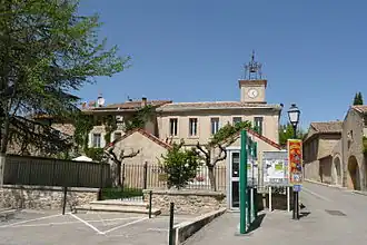 A view within the village of Puyvert | |
.svg.png) Coat of arms | |
Location of Puyvert | |
 Puyvert 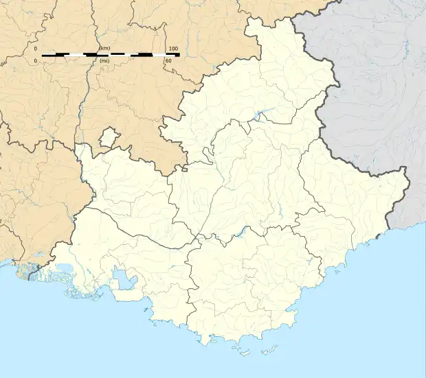 Puyvert | |
| Coordinates: 43°45′36″N 5°20′38″E / 43.76°N 5.3439°E | |
| Country | France |
| Region | Provence-Alpes-Côte d'Azur |
| Department | Vaucluse |
| Arrondissement | Apt |
| Canton | Cheval-Blanc |
| Intercommunality | CA Luberon Monts de Vaucluse |
| Government | |
| • Mayor (2020–2026) | Sylvie Gregoire[1] |
Area 1 | 9.78 km2 (3.78 sq mi) |
| Population (2022)[2] | 842 |
| • Density | 86/km2 (220/sq mi) |
| Time zone | UTC+01:00 (CET) |
| • Summer (DST) | UTC+02:00 (CEST) |
| INSEE/Postal code | 84095 /84160 |
| Elevation | 141–615 m (463–2,018 ft) (avg. 150 m or 490 ft) |
| 1 French Land Register data, which excludes lakes, ponds, glaciers > 1 km2 (0.386 sq mi or 247 acres) and river estuaries. | |
Puyvert (French pronunciation: [pɥivɛʁ]; Occitan: Puègvèrd) is a commune in the Vaucluse department in the Provence-Alpes-Côte d'Azur region in southeastern France.
Puyvert borders the Bouches du Rhone department, sitting on the river Durance.
The former priory of Saint-Pierre de Mejans was seized by the state during the French Revolution and is now managed as a chateau vineyard and events venue.[3]
See also
References
- ^ "Répertoire national des élus: les maires" (in French). data.gouv.fr, Plateforme ouverte des données publiques françaises. 13 September 2022.
- ^ "Populations de référence 2022" (in French). The National Institute of Statistics and Economic Studies. 19 December 2024.
- ^ "Vineyard in Puyvert". St Pierre de Mejans. Retrieved 19 September 2022.
Wikimedia Commons has media related to Puyvert.