Pulletop, New South Wales
| Pulletop New South Wales | |
|---|---|
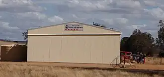 Pulletop Fire Brigade Shed | |
 Pulletop Location in New South Wales | |
| Coordinates | 35°27′03″S 147°23′24″E / 35.45083°S 147.39000°E |
| Population | 64 (SAL 2021)[1] |
| Postcode(s) | 2650 |
| Location |
|
| LGA(s) | City of Wagga Wagga |
| County | Mitchell |
| State electorate(s) | Wagga Wagga |
Pulletop is a rural locality in the south eastern part of the Riverina - it used to be called Pullitop. It is situated by road, about 5 kilometres east south-east of Burrandana[2] and 9 kilometres north of Westby.
See also
Notes and references
- ^ Australian Bureau of Statistics (28 June 2022). "Pulletop (suburb and locality)". Australian Census 2021 QuickStats. Retrieved 28 June 2022.
- ^ "Pulletop". Geographical Names Register (GNR) of NSW. Geographical Names Board of New South Wales.
Wikimedia Commons has media related to Pulletop, New South Wales.