Prat, Côtes-d'Armor
Prat
Prad | |
|---|---|
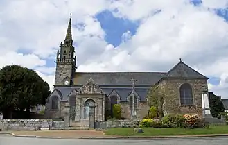 The church of Saint-Pierre, in Prat | |
Location of Prat | |
 Prat  Prat | |
| Coordinates: 48°40′39″N 3°17′47″W / 48.6775°N 3.2964°W | |
| Country | France |
| Region | Brittany |
| Department | Côtes-d'Armor |
| Arrondissement | Lannion |
| Canton | Bégard |
| Intercommunality | Lannion-Trégor Communauté |
| Government | |
| • Mayor (2020–2026) | Michel Even[1] |
Area 1 | 21.87 km2 (8.44 sq mi) |
| Population (2022)[2] | 1,090 |
| • Density | 50/km2 (130/sq mi) |
| Time zone | UTC+01:00 (CET) |
| • Summer (DST) | UTC+02:00 (CEST) |
| INSEE/Postal code | 22254 /22140 |
| Elevation | 19–112 m (62–367 ft) |
| 1 French Land Register data, which excludes lakes, ponds, glaciers > 1 km2 (0.386 sq mi or 247 acres) and river estuaries. | |
Prat (French pronunciation: [pʁat] ⓘ; Breton: Prad) is a commune in the Côtes-d'Armor department of Brittany in northwestern France.
Population
Inhabitants of Prat are called pratais in French.
Breton language
The municipality launched a linguistic plan through Ya d'ar brezhoneg on 27 May 2006.
Sights
The fifteenth century Trévoazan church collapsed in the 1910s and was designated as a historic landmark in 1926. The remains of the frontage and the tower can still be seen. The Manoir de Coatelan, also from the fifteenth century, was classified as a historic monument in 1927.
See also
References
- ^ "Répertoire national des élus: les maires" (in French). data.gouv.fr, Plateforme ouverte des données publiques françaises. 13 September 2022.
- ^ "Populations de référence 2022" (in French). The National Institute of Statistics and Economic Studies. 19 December 2024.
External links
Wikimedia Commons has media related to Prat.
- Base Mérimée: Search for heritage in the commune, Ministère français de la Culture. (in French)