Châtelaudren-Plouagat
Châtelaudren-Plouagat | |
|---|---|
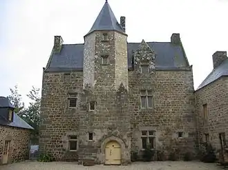 Manor house of Fournebello | |
Location of Châtelaudren-Plouagat | |
 Châtelaudren-Plouagat  Châtelaudren-Plouagat | |
| Coordinates: 48°32′15″N 2°59′51″W / 48.5375°N 2.9975°W | |
| Country | France |
| Region | Brittany |
| Department | Côtes-d'Armor |
| Arrondissement | Guingamp |
| Canton | Plélo |
| Intercommunality | Leff Armor |
| Government | |
| • Mayor (2020–2026) | Olivier Boissière[1] |
Area 1 | 32.44 km2 (12.53 sq mi) |
| Population (2022)[2] | 3,968 |
| • Density | 120/km2 (320/sq mi) |
| Time zone | UTC+01:00 (CET) |
| • Summer (DST) | UTC+02:00 (CEST) |
| INSEE/Postal code | 22206 /22170 |
| Elevation | 68–262 m (223–860 ft) |
| 1 French Land Register data, which excludes lakes, ponds, glaciers > 1 km2 (0.386 sq mi or 247 acres) and river estuaries. | |
Châtelaudren-Plouagat (French pronunciation: [ʃatɛlodʁɛ̃ pluaɡat]; Breton: Kastellaodren-Plagad) is a commune in the Côtes-d'Armor department of Brittany in northwestern France. It was established on 1 January 2019 by merger of the former communes of Plouagat (the seat) and Châtelaudren.[3]
Population
| Year | Pop. | ±% p.a. |
|---|---|---|
| 1968 | 2,600 | — |
| 1975 | 2,715 | +0.62% |
| 1982 | 2,951 | +1.20% |
| 1990 | 3,101 | +0.62% |
| 1999 | 3,142 | +0.15% |
| 2007 | 3,382 | +0.92% |
| 2012 | 3,650 | +1.54% |
| 2017 | 3,868 | +1.17% |
| Source: INSEE[4] | ||
See also
References
- ^ "Répertoire national des élus: les maires" (in French). data.gouv.fr, Plateforme ouverte des données publiques françaises. 13 September 2022.
- ^ "Populations de référence 2022" (in French). The National Institute of Statistics and Economic Studies. 19 December 2024.
- ^ Arrêté préfectoral 28 September 2018 (in French)
- ^ Population en historique depuis 1968, INSEE
Wikimedia Commons has media related to Châtelaudren-Plouagat.