Poucharramet
Poucharramet | |
|---|---|
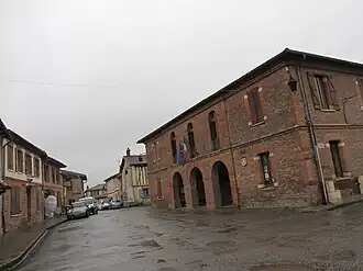 The town hall in Poucharramet | |
.svg.png) Coat of arms | |
Location of Poucharramet | |
 Poucharramet  Poucharramet | |
| Coordinates: 43°25′05″N 1°10′29″E / 43.4181°N 1.1747°E | |
| Country | France |
| Region | Occitania |
| Department | Haute-Garonne |
| Arrondissement | Muret |
| Canton | Cazères |
| Government | |
| • Mayor (2021–2026) | David Cours[1] |
Area 1 | 22.53 km2 (8.70 sq mi) |
| Population (2022)[2] | 968 |
| • Density | 43/km2 (110/sq mi) |
| Time zone | UTC+01:00 (CET) |
| • Summer (DST) | UTC+02:00 (CEST) |
| INSEE/Postal code | 31435 /31370 |
| Elevation | 196–260 m (643–853 ft) (avg. 235 m or 771 ft) |
| 1 French Land Register data, which excludes lakes, ponds, glaciers > 1 km2 (0.386 sq mi or 247 acres) and river estuaries. | |
Poucharramet (French pronunciation: [puʃaʁamɛ]; Occitan: Pojarramet) is a commune in the Haute-Garonne department in southwestern France.
Population
| Year | Pop. | ±% |
|---|---|---|
| 1962 | 484 | — |
| 1968 | 504 | +4.1% |
| 1975 | 560 | +11.1% |
| 1982 | 621 | +10.9% |
| 1990 | 649 | +4.5% |
| 1999 | 680 | +4.8% |
| 2008 | 829 | +21.9% |
See also
References
- ^ "Répertoire national des élus: les maires" (in French). data.gouv.fr, Plateforme ouverte des données publiques françaises. 4 May 2022.
- ^ "Populations de référence 2022" (in French). The National Institute of Statistics and Economic Studies. 19 December 2024.
Wikimedia Commons has media related to Poucharramet.