Outriaz
Outriaz | |
|---|---|
Commune | |
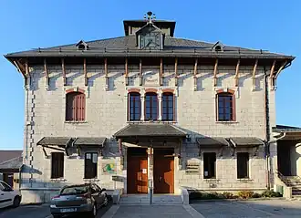 Town hall | |
Location of Outriaz | |
 Outriaz  Outriaz | |
| Coordinates: 46°04′05″N 5°32′51″E / 46.0681°N 5.5475°E | |
| Country | France |
| Region | Auvergne-Rhône-Alpes |
| Department | Ain |
| Arrondissement | Nantua |
| Canton | Plateau d'Hauteville |
| Intercommunality | Haut-Bugey Agglomération |
| Government | |
| • Mayor (2020–2026) | Claude Morel[1] |
Area 1 | 5.91 km2 (2.28 sq mi) |
| Population (2022)[2] | 258 |
| • Density | 44/km2 (110/sq mi) |
| Time zone | UTC+01:00 (CET) |
| • Summer (DST) | UTC+02:00 (CEST) |
| INSEE/Postal code | 01282 /01430 |
| Elevation | 647–1,103 m (2,123–3,619 ft) (avg. 680 m or 2,230 ft) |
| 1 French Land Register data, which excludes lakes, ponds, glaciers > 1 km2 (0.386 sq mi or 247 acres) and river estuaries. | |
Outriaz is a commune in the Ain department in eastern France.
Population
| Year | Pop. | ±% p.a. |
|---|---|---|
| 1968 | 225 | — |
| 1975 | 204 | −1.39% |
| 1982 | 255 | +3.24% |
| 1990 | 275 | +0.95% |
| 1999 | 264 | −0.45% |
| 2009 | 256 | −0.31% |
| 2014 | 258 | +0.16% |
| 2020 | 258 | +0.00% |
| Source: INSEE[3] | ||
See also
References
- ^ "Répertoire national des élus: les maires" (in French). data.gouv.fr, Plateforme ouverte des données publiques françaises. 13 September 2022. Archived from the original on 28 June 2020. Retrieved 6 May 2024.
- ^ "Populations de référence 2022" (in French). The National Institute of Statistics and Economic Studies. 19 December 2024.
- ^ Population en historique depuis 1968 Archived 12 December 2023 at the Wayback Machine, INSEE
Wikimedia Commons has media related to Outriaz.