Montague Gardens, Cape Town
Montague Gardens | |
|---|---|
| Coordinates: 33°51′40″S 18°31′17″E / 33.8611°S 18.5214°E | |
| Country | South Africa |
| Province | Western Cape |
| Municipality | City of Cape Town |
| Area | |
• Total | 4.23 km2 (1.63 sq mi) |
| Population (2011)[1] | |
• Total | 22 |
| • Density | 5.2/km2 (13/sq mi) |
| Racial makeup (2011) | |
| • Black African | 81.82% |
| • Coloured | 13.64% |
| • Asian | 4.55% |
| First languages (2011) | |
| • Afrikaans | 18.18% |
| • English | 27.27% |
| • Xhosa | 27.27% |
| • Zulu | 22.73 |
| • Other | 4.55% |
| Time zone | UTC+2 (SAST) |
| Postal code (street) | 7441 |
| PO box | 7441 |
Montague Gardens is an industrial area in the Northern Suburbs region of Cape Town, South Africa. The suburb comprises many warehouses, large format stores, and distribution centers.
As at the South African 2011 census, the area had a population of just 22 residents.[1]
Location
Montague Gardens is located just off the N7 highway, in the Northern Suburbs of Cape Town. The area is situated roughly 15 km from Cape Town CBD, 15 km from the Port of Cape Town, and 20 km from Cape Town International Airport.
The suburb is separated from Cape Town's other major industrial neighborhoods, like Epping, Parow, Ndabeni, and Paarden Eiland, by the mixed-use suburb of Century City.
Neighboring suburbs include Milnerton Ridge, Milnerton, Edgemead, Bothasig, and Summer Greens.
Commerce
Companies with a retail presence in Montague Gardens include Italtile, Dulux, Bostik, Coricraft, PPC, BUCO, and Defy.
Companies housing distribution centers in the area include Woolworths, Decofurn, Clicks, and Takealot.
Gallery
-
 Furniture retail chain Decofurn's headquarters, showroom, and distribution center
 -
 E-commerce retailer Takealot's distribution center
 -
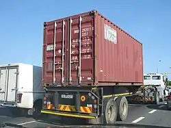 20 foot shipping container on the back of a truck
References