Merdzavan
Merdzavan
Մերձավան | |
|---|---|
 Merdzavan | |
| Coordinates: 40°10′47″N 44°23′59″E / 40.17972°N 44.39972°E | |
| Country | Armenia |
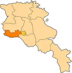
| Province | Armavir |
| Founded | 1947 |
| Elevation | 945 m (3,100 ft) |
| Population (2011) | |
• Total | 3,303[1] |
| Time zone | UTC+4 ( ) |
| • Summer (DST) | UTC+5 ( ) |
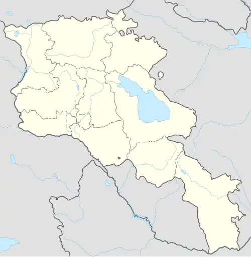
40°10′47″N 44°23′59″E / 40.17972°N 44.39972°E Merdzavan (Armenian: Մերձավան), is a village in the Armavir Province of Armenia, located at the western suburbs of the capital Yerevan, north of the Parakar village.
As of the 2011 official census, Merdzavan has a population of 3,303.[2]
Geography
At a height of 945 meters above sea level, Merdzavan is located to the western edge of the Malatia-Sebastia District of the capital Yerevan. It is 40 km east of the provincial centre Armavir and 6 km east of Vagharshapat.
See also
References
- ^ "Armavir (Armenia): Towns and Villages in Municipalities". www.citypopulation.de. Retrieved 2024-11-10.
- ^ 2011 census: Armavir