Marcillé
Marcillé | |
|---|---|
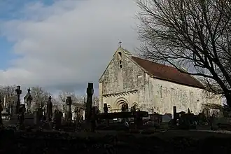 The church in Saint-Génard | |
Location of Marcillé | |
 Marcillé  Marcillé | |
| Coordinates: 46°10′58″N 0°08′01″W / 46.1828°N 0.1336°W | |
| Country | France |
| Region | Nouvelle-Aquitaine |
| Department | Deux-Sèvres |
| Arrondissement | Niort |
| Canton | Melle |
| Intercommunality | Mellois-en-Poitou |
Area 1 | 18.22 km2 (7.03 sq mi) |
| Population (2022)[1] | 726 |
| • Density | 40/km2 (100/sq mi) |
| Time zone | UTC+01:00 (CET) |
| • Summer (DST) | UTC+02:00 (CEST) |
| INSEE/Postal code | 79251 /79500 |
| Elevation | 84–148 m (276–486 ft) |
| 1 French Land Register data, which excludes lakes, ponds, glaciers > 1 km2 (0.386 sq mi or 247 acres) and river estuaries. | |
Marcillé is a commune in the Deux-Sèvres department in western France. It was established on 1 January 2019 by merger of the former communes of Saint-Génard (the seat) and Pouffonds.[2]
See also
References
- ^ "Populations de référence 2022" (in French). The National Institute of Statistics and Economic Studies. 19 December 2024.
- ^ Arrêté préfectoral 6 July 2018 (in French)
Wikimedia Commons has media related to Marcillé (Deux-Sèvres).