Kanor, Rajasthan
Kanore
Kanore | |
|---|---|
Tehsil & Nagar Palika | |
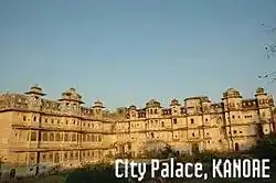 Kanore Palace | |
| Nickname: City of Ponds | |
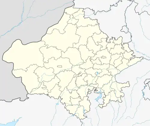 Kanore Location in Rajasthan, India  Kanore Kanore (India) | |
| Coordinates: 24°26′N 74°16′E / 24.43°N 74.27°E | |
| Country | India |
| State | Rajasthan |
| District | Udaipur |
| Government | |
| • Body | Nagar Palika |
| Elevation | 469 m (1,539 ft) |
| Population (2001) | |
• Total | 12,616 |
| Languages | |
| • Official | Hindi, Mewari |
| Time zone | UTC+5:30 (IST) |
| ISO 3166 code | RJ-IN |
| Vehicle registration | RJ-27 |
Kanore is a town in Udaipur district in the Indian state of Rajasthan.
Geography
Kanore is located at 24°26′N 74°16′E / 24.43°N 74.27°E.[1] It has an average elevation of 469 metres (1,539 ft).
Demographics
As of 2001 India census,[2] Kanor had a population of 12,616. Males constitute 54% of the population and females 46%. Kanor has an average literacy rate of 67%, higher than the national average of 59.5%: male literacy is 78%, and female literacy is 54%. In Kanor, 12% of the population is under 6 years of age.
References
- ^ Falling Rain Genomics, Inc – Kanore
- ^ "Census of India 2001: Data from the 2001 Census, including cities, villages and towns (Provisional)". Registrar General and Census Commissioner of India. Archived from the original on 16 June 2004. Retrieved 1 November 2008.