Jagannath Prasad, Ganjam
Jagannath Prasad | |
|---|---|
Town | |
| Nickname: JNP | |
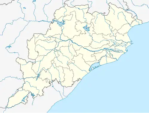 Jagannath Prasad Location in Odisha, India  Jagannath Prasad Jagannath Prasad (India) | |
| Coordinates: 19°58′N 84°46′E / 19.97°N 84.77°E | |
| Country | |
| State | |
| District | Ganjam |
| Named after | Lord Jagannath |
| Government | |
| • Type | Democratic |
| • Body | Sarpanch (Head of Village) |
| • Member of Legislative Assembly | Bikram Keshari Arukha(Bhanjanagar-BJD) |
| • Member of Parliament | Dr. Achyuta Samanta(Kandhamal-BJD) |
| Elevation | 11 m (36 ft) |
| Population (2011) | |
• Total | 79,901 (JNP Block)[1] 4,527 (JNP Only) [2] |
| Languages | |
| • Official | Odia |
| Time zone | UTC+5:30 (IST) |
| PIN | 761121 |
| Telephone code | 06818 |
| Vehicle registration |
|
| District | Ganjam |
| Panchayat samiti (block) | Jagannathprasad |
| Legislative Assembly Constituency | Bhanjanagar |
| Parliament Constituency | Kandhamal |
| Website | odisha |
Jagannath Prasad is a small semi-urban town in Odisha, India. Jagannath Prasad is located on State Highway No.21, connecting Bhanjanagar to Nayagarh.
Demographics
As of 2011 India census, Jagannathprasad had a population of 4,527. Males constitute 50.98% of the population (i.e. 2308) and females 49.02% (i.e. 2219). 10.13% of the population (i.e. 459) is under 6 years of age.[2]
Jagannath Prasad Block
List of all towns and Villages in JAGANNATH PRASAD Block of Ganjam district, Odisha with population details according to 2011 census data.[1]
| # | Villages | Population |
|---|---|---|
| 1 | Akulakumpa | 101 |
| 2 | Alasuguma | 2,986 |
| 3 | Alladi | 1,301 |
| 4 | Angyaprasad | 1,107 |
| 5 | Banikhola | 40 |
| 6 | Barabara | 55 |
| 7 | Beguniadiha | 380 |
| 8 | Bhabasara | 811 |
| 9 | Bhuktabhumi | 747 |
| 10 | Bhusandapala | 855 |
| 11 | Bijayadhanurjayapur | 1,379 |
| 12 | Budurungu | 1,070 |
| 13 | Chadheiapalli | 2,215 |
| 14 | Chancharapalli | 190 |
| 15 | Charikonia | 1,029 |
| 16 | Chelakhai | 57 |
| 17 | Chhamunda | 3,686 |
| 18 | Chikili | 1,234 |
| 19 | Chopara | 1,682 |
| 20 | Deullapalli | 70 |
| 21 | Dhimiripalli | 126 |
| 22 | Dhodapalli | 634 |
| 23 | Dungapalli | 559 |
| 24 | Ekagharia | 131 |
| 25 | Ekaghariapalli | 186 |
| 26 | Gadisapalli | 727 |
| 27 | Gandadhara | 1,053 |
| 28 | Ganiapalli | 194 |
| 29 | Gochabadi | 1,803 |
| 30 | Gundurisahi | 671 |
| 31 | Haripur | 1,229 |
| 32 | Jagannathprasad | 4,527 |
| 33 | Jagannathpur | 361 |
| 34 | Jamagarada | 802 |
| 35 | Jhadabhumi | 1,879 |
| 36 | Jhadasahi | 612 |
| 37 | Jirabadi | 2,366 |
| 38 | Jodabandha | 644 |
| 39 | Kadapada | 1,434 |
| 40 | Kaduamangarajpur | 1,966 |
| 41 | Kamasaragada | 2,408 |
| 42 | Kandarasingi | 1,356 |
| 43 | Kandhanuapalli | 1,128 |
| 44 | Karadapalli | 357 |
| 45 | Khairanati | 763 |
| 46 | Khamarapalli | 1,353 |
| 47 | Kriadhara | 139 |
| 48 | Kumpapada | 2,945 |
| 49 | Kumunda | 1,170 |
| 50 | Kumundi | 622 |
| 51 | Kusapali | 752 |
| 52 | Lepa | 332 |
| 53 | Mahuliagada | 484 |
| 54 | Malingi | 603 |
| 55 | Mentapur | 864 |
| 56 | Nada | 959 |
| 57 | Paikarapalli | 798 |
| 58 | Panchabhuti | 4,649 |
| 59 | Pandiripada | 180 |
| 60 | Pankalasahi | 670 |
| 61 | Pantiama | 21 |
| 62 | Pattadhara | 2,441 |
| 63 | Pelapada | 383 |
| 64 | Ranibhumi | 617 |
| 65 | Rauti | 1,891 |
| 66 | Sarakumpa | 564 |
| 67 | Singipur | 1,654 |
| 68 | Sisunda | 1,240 |
| 69 | Sorisamuli | 666 |
| 70 | Sugumu | 195 |
| 71 | Talaponka | 113 |
| 72 | Tamanada | 1,329 |
| 73 | Taraffa | 778 |
| 74 | Tentulia | 832 |
| 75 | Tholanda | 1,446 |
| 76 | Tikarapalli | 300 |
Geography
Latitude 19.9406685 Longitude 84.9125509 It is in the 11 m elevation(altitude) above sea level.
Weather and Climate
Jagannathprasad is hot in summer, the highest day temperature ranges between 30 °C to 37 °C. The average temperature of January is 23 °C, February is 24 °C, March is 28 °C, April is 30 °C, May is 31 °C.
Famous places
The following are popular recreational spots of Jagannathprasad:
- Lankagada Dam (Picnic Spot)
- Rani Gonda Water Reservoir
- Raghunath Jiu Temple
- Sri Dadhibaman Jiu & Jagannath Temple
Transport
It is perfectly connected by all channels of transport with other major cities of Odisha, such as the Capital City Bhubaneswar and the Silk City Berhampur.
- By rail : Berhampur is the nearest railway station which is about 110 km from Jagannath Prasad town.
- By air : Biju Patnaik International Airport, BBSR is about 140 km far from the town.
- By bus : As mentioned above it is properly connected by road with other cities of Odisha. Bhanjanagar(one of the 3 Sub-divisions of Ganjam district) is the main town very close to JNP. Buses are coming from every corners of Odisha.
Banks
- Indian Bank, Jagannath Prasad (IFSC Code : IDIB000J001, MICR Code: 761019009)
- State Bank Of India, Jagannath Prasad (IFSC Code : SBIN0012113, MICR Code: 760002508)
- Utkal Grameen Bank, Jagannath Prasad (IFSC Code : SBIN0RRUKGB)
- The Aska Coop Central Bank Limited (IFSC Code : UTIB0SASKAC)
Education institutions in Jagannath Prasad
Elementary and Higher Secondary Schools
- Nodal U.P. School, Jagannath Prasad
- Judhisthir Bidyapitha (Boys' High School)
- N.P. Girls' High School
- Odisha Adarsha Vidyalaya, Jagannath Prasad (located at Jamagarada, 5 km from JNP)
- Apart from the above schools, there are 3 more Govt. U.P. schools and 4 private schools
Colleges
- Anchalika Higher Secondary School (+2 Arts, Science, Commerce)
- Government Vocational Higher Secondary School (+2EDA & OM)
- Anchalika Degree Mahavidyalaya (+3 Arts)