Houdetot
Houdetot | |
|---|---|
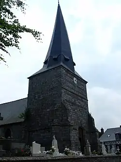 The church in Houdetot | |
Location of Houdetot | |
 Houdetot  Houdetot | |
| Coordinates: 49°48′54″N 0°48′14″E / 49.815°N 0.8039°E | |
| Country | France |
| Region | Normandy |
| Department | Seine-Maritime |
| Arrondissement | Dieppe |
| Canton | Saint-Valery-en-Caux |
| Intercommunality | CC Côte d'Albâtre |
| Government | |
| • Mayor (2020–2026) | Jean-Paul Renaux[1] |
Area 1 | 5.77 km2 (2.23 sq mi) |
| Population (2022)[2] | 194 |
| • Density | 34/km2 (87/sq mi) |
| Time zone | UTC+01:00 (CET) |
| • Summer (DST) | UTC+02:00 (CEST) |
| INSEE/Postal code | 76365 /76740 |
| Elevation | 63–103 m (207–338 ft) (avg. 85 m or 279 ft) |
| 1 French Land Register data, which excludes lakes, ponds, glaciers > 1 km2 (0.386 sq mi or 247 acres) and river estuaries. | |
Houdetot is a commune in the Seine-Maritime department in the Normandy region in northern France.
Geography
A small farming village in the Pays de Caux situated some 17 miles (27 km) southwest of Dieppe at the junction of the D70 and the D437 roads.
Population
| Year | Pop. | ±% p.a. |
|---|---|---|
| 1968 | 167 | — |
| 1975 | 153 | −1.24% |
| 1982 | 135 | −1.77% |
| 1990 | 136 | +0.09% |
| 1999 | 135 | −0.08% |
| 2007 | 162 | +2.31% |
| 2012 | 167 | +0.61% |
| 2017 | 180 | +1.51% |
| Source: INSEE[3] | ||
Places of interest
- The church of St.Pierre, dating from the thirteenth century.
- Traces of a castle dating from medieval times.
See also
References
- ^ Liste des maires du département de la Seine-Maritime, 10 August 2020
- ^ "Populations de référence 2022" (in French). The National Institute of Statistics and Economic Studies. 19 December 2024.
- ^ Population en historique depuis 1968, INSEE
Wikimedia Commons has media related to Houdetot.