Horka u Staré Paky
Horka u Staré Paky | |
|---|---|
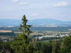 View of Horka u Staré Paky and the Giant Mountains | |
 Flag 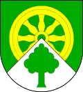 Coat of arms | |
 Horka u Staré Paky Location in the Czech Republic | |
| Coordinates: 50°31′34″N 15°34′33″E / 50.52611°N 15.57583°E | |
| Country | |
| Region | Liberec |
| District | Semily |
| Founded | 1823 |
| Area | |
• Total | 2.03 km2 (0.78 sq mi) |
| Elevation | 503 m (1,650 ft) |
| Population (2025-01-01)[1] | |
• Total | 232 |
| • Density | 110/km2 (300/sq mi) |
| Time zone | UTC+1 (CET) |
| • Summer (DST) | UTC+2 (CEST) |
| Postal code | 512 34 |
| Website | www |
Horka u Staré Paky is a municipality and village in Semily District in the Liberec Region of the Czech Republic. It has about 200 inhabitants.
Administrative division
Horka u Staré Paky consists of two municipal parts (in brackets population according to the 2021 census):[2]
- Horka u Staré Paky (141)
- Nedaříž (103)
Demographics
| Year | Pop. | ±% |
|---|---|---|
| 1869 | 449 | — |
| 1880 | 308 | −31.4% |
| 1890 | 324 | +5.2% |
| 1900 | 305 | −5.9% |
| 1910 | 365 | +19.7% |
| 1921 | 477 | +30.7% |
| 1930 | 456 | −4.4% |
| 1950 | 324 | −28.9% |
| 1961 | 340 | +4.9% |
| 1970 | 288 | −15.3% |
| 1980 | 296 | +2.8% |
| 1991 | 261 | −11.8% |
| 2001 | 255 | −2.3% |
| 2011 | 280 | +9.8% |
| 2021 | 244 | −12.9% |
| Source: Censuses[3][4] | ||
References
- ^ "Population of Municipalities – 1 January 2025". Czech Statistical Office. 2025-05-16.
- ^ "Public Census 2021 – basic data". Public Database (in Czech). Czech Statistical Office. 2022.
- ^ "Historický lexikon obcí České republiky 1869–2011" (in Czech). Czech Statistical Office. 2015-12-21.
- ^ "Population Census 2021: Population by sex". Public Database. Czech Statistical Office. 2021-03-27.
External links
Wikimedia Commons has media related to Horka u Staré Paky.