Georgetown, Luzerne County, Pennsylvania
Georgetown, Pennsylvania | |
|---|---|
%252C_Sept._2023.jpg) Northbound Northampton Street | |
 Georgetown Location in Pennsylvania  Georgetown Location in the United States | |
| Coordinates: 41°13′35″N 75°52′19″W / 41.22639°N 75.87194°W | |
| Country | United States |
| State | Pennsylvania |
| County | Luzerne |
| Township | Wilkes-Barre |
| Area | |
• Total | 0.7 sq mi (1.9 km2) |
| • Land | 0.7 sq mi (1.9 km2) |
| • Water | 0 sq mi (0 km2) |
| Population (2010) | |
• Total | 1,640 |
| • Density | 2,200/sq mi (860/km2) |
| Time zone | UTC-5 (Eastern (EST)) |
| • Summer (DST) | UTC-4 (EDT) |
| ZIP code | 18702 |
| Area code | 570 |
Georgetown is a census-designated place (CDP) in Wilkes-Barre Township, Luzerne County, Pennsylvania, United States, adjacent to the city of Wilkes-Barre. The CDP population was 1,640 at the 2010 census.[1]
Geography
Georgetown is located at 41°13′35″N 75°52′19″W / 41.22639°N 75.87194°W.[2]
According to the United States Census Bureau, the CDP has a total area of 0.73 square miles (1.9 km2), all land. Georgetown occupies most of the southwestern half of Wilkes-Barre Township and is bisected by I-81/PA 309. Exit 165 of I-81 is located at the southwestern edge of the CDP. The city of Wilkes-Barre is to the northwest.
Education
It is in the Wilkes-Barre Area School District.[3]
References
- ^ "Profile of General Population and Housing Characteristics: 2010 Demographic Profile Data (DP-1): Georgetown CDP (Luzerne County), Pennsylvania". United States Census Bureau. Retrieved April 20, 2012.
- ^ "US Gazetteer files: 2010, 2000, and 1990". United States Census Bureau. February 12, 2011. Retrieved April 23, 2011.
- ^ "2020 CENSUS - SCHOOL DISTRICT REFERENCE MAP: Luzerne County, PA" (PDF). U.S. Census Bureau. Retrieved December 13, 2024. - Text list
Places adjacent to Georgetown, Luzerne County, Pennsylvania | ||||||||||||||||
|---|---|---|---|---|---|---|---|---|---|---|---|---|---|---|---|---|
| ||||||||||||||||
Municipalities and communities of Luzerne County, Pennsylvania, United States | ||
|---|---|---|
| Cities | 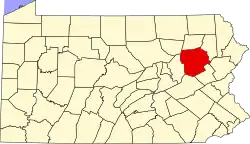 | |
| Boroughs |
| |
| Townships | ||
| CDPs | ||
| Unincorporated communities |
| |
| Footnotes | ‡This populated place also has portions in an adjacent county or counties | |