Erdre-en-Anjou
Erdre-en-Anjou | |
|---|---|
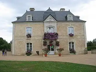 The town hall of Brain-sur-Longuenée | |
Location of Erdre-en-Anjou | |
 Erdre-en-Anjou 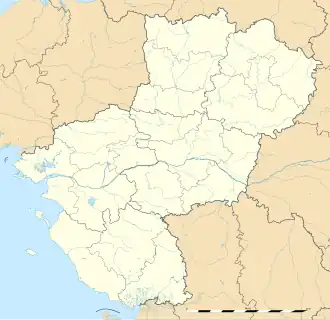 Erdre-en-Anjou | |
| Coordinates: 47°36′04″N 0°50′06″W / 47.601°N 0.835°W | |
| Country | France |
| Region | Pays de la Loire |
| Department | Maine-et-Loire |
| Arrondissement | Segré |
| Canton | Chalonnes-sur-Loire, Tiercé |
| Government | |
| • Mayor (2021–2026) | Yamina Riou[1] |
Area 1 | 89.94 km2 (34.73 sq mi) |
| Population (2022)[2] | 5,784 |
| • Density | 64/km2 (170/sq mi) |
| Time zone | UTC+01:00 (CET) |
| • Summer (DST) | UTC+02:00 (CEST) |
| INSEE/Postal code | 49367 /49220, 49370 |
| 1 French Land Register data, which excludes lakes, ponds, glaciers > 1 km2 (0.386 sq mi or 247 acres) and river estuaries. | |
Erdre-en-Anjou (French pronunciation: [ɛʁdʁ ɑ̃.n‿ɑ̃ʒu] ⓘ, literally Erdre in Anjou) is a commune in the Maine-et-Loire department of western France. Vern-d'Anjou is the municipal seat.
History
It was established on 28 December 2015 and consists of the former communes of Brain-sur-Longuenée, Gené, La Pouëze and Vern-d'Anjou.[3]
Population
The population data given in the table below refer to the commune in its geography as of January 2020.
| Year | Pop. | ±% p.a. |
|---|---|---|
| 1968 | 3,583 | — |
| 1975 | 3,388 | −0.80% |
| 1982 | 3,647 | +1.06% |
| 1990 | 3,823 | +0.59% |
| 1999 | 4,011 | +0.53% |
| 2007 | 4,844 | +2.39% |
| 2012 | 5,630 | +3.05% |
| 2017 | 5,746 | +0.41% |
| Source: INSEE[4] | ||
See also
References
Wikimedia Commons has media related to Erdre-en-Anjou.
- ^ "Répertoire national des élus: les maires" (in French). data.gouv.fr, Plateforme ouverte des données publiques françaises. 4 May 2022.
- ^ "Populations de référence 2022" (in French). The National Institute of Statistics and Economic Studies. 19 December 2024.
- ^ Arrêté préfectoral Archived 24 December 2015 at the Wayback Machine 23 December 2015 (in French)
- ^ Population en historique depuis 1968, INSEE