Chamblet
Chamblet | |
|---|---|
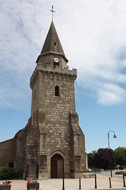 The church in Chamblet | |
Location of Chamblet | |
 Chamblet  Chamblet | |
| Coordinates: 46°20′01″N 2°42′11″E / 46.3336°N 2.7031°E | |
| Country | France |
| Region | Auvergne-Rhône-Alpes |
| Department | Allier |
| Arrondissement | Montluçon |
| Canton | Commentry |
| Intercommunality | Commentry Montmarault Néris Communauté |
| Government | |
| • Mayor (2020–2026) | Alain Chanier[1] |
Area 1 | 20.5 km2 (7.9 sq mi) |
| Population (2022)[2] | 1,079 |
| • Density | 53/km2 (140/sq mi) |
| Time zone | UTC+01:00 (CET) |
| • Summer (DST) | UTC+02:00 (CEST) |
| INSEE/Postal code | 03052 /03170 |
| Elevation | 279–393 m (915–1,289 ft) (avg. 350 m or 1,150 ft) |
| 1 French Land Register data, which excludes lakes, ponds, glaciers > 1 km2 (0.386 sq mi or 247 acres) and river estuaries. | |
Chamblet (French pronunciation: [ʃɑ̃blɛ]) is a commune in the Allier department in central France.
Population
| Year | Pop. | ±% p.a. |
|---|---|---|
| 1968 | 855 | — |
| 1975 | 807 | −0.82% |
| 1982 | 932 | +2.08% |
| 1990 | 1,046 | +1.45% |
| 1999 | 941 | −1.17% |
| 2009 | 1,069 | +1.28% |
| 2014 | 1,097 | +0.52% |
| 2020 | 1,090 | −0.11% |
| Source: INSEE[3] | ||
See also
References
- ^ "Répertoire national des élus: les maires" (in French). data.gouv.fr, Plateforme ouverte des données publiques françaises. 13 September 2022.
- ^ "Populations de référence 2022" (in French). The National Institute of Statistics and Economic Studies. 19 December 2024.
- ^ Population en historique depuis 1968, INSEE
Wikimedia Commons has media related to Chamblet.