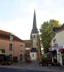
Châtres-sur-Cher
Châtres-sur-Cher | |
|---|---|
 | |
 Coat of arms | |
Location of Châtres-sur-Cher | |
 Châtres-sur-Cher 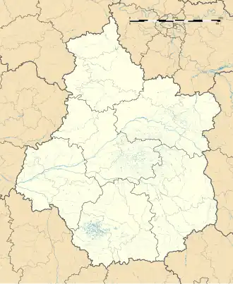 Châtres-sur-Cher | |
| Coordinates: 47°15′57″N 1°54′25″E / 47.2658°N 1.9069°E | |
| Country | France |
| Region | Centre-Val de Loire |
| Department | Loir-et-Cher |
| Arrondissement | Romorantin-Lanthenay |
| Canton | Selles-sur-Cher |
| Government | |
| • Mayor (2024–2026) | Claude de Carfort[1] |
Area 1 | 35.33 km2 (13.64 sq mi) |
| Population (2022)[2] | 1,134 |
| • Density | 32/km2 (83/sq mi) |
| Time zone | UTC+01:00 (CET) |
| • Summer (DST) | UTC+02:00 (CEST) |
| INSEE/Postal code | 41044 /41320 |
| Elevation | 87–157 m (285–515 ft) (avg. 103 m or 338 ft) |
| 1 French Land Register data, which excludes lakes, ponds, glaciers > 1 km2 (0.386 sq mi or 247 acres) and river estuaries. | |
Châtres-sur-Cher (French pronunciation: [ʃatʁ syʁ ʃɛʁ], literally Châtres on Cher) is a commune in the Loir-et-Cher department, central France.[3]
Geography
The Rère forms the commune's northern border. The Cher forms part of the commune's southern border.
Population
| Year | Pop. | ±% p.a. |
|---|---|---|
| 1968 | 1,059 | — |
| 1975 | 1,009 | −0.69% |
| 1982 | 1,110 | +1.37% |
| 1990 | 1,074 | −0.41% |
| 1999 | 1,129 | +0.56% |
| 2007 | 1,075 | −0.61% |
| 2012 | 1,106 | +0.57% |
| 2017 | 1,097 | −0.16% |
| Source: INSEE[4] | ||
See also
References
- ^ "Répertoire national des élus: les maires" (in French). data.gouv.fr, Plateforme ouverte des données publiques françaises. 16 April 2024.
- ^ "Populations de référence 2022" (in French). The National Institute of Statistics and Economic Studies. 19 December 2024.
- ^ INSEE commune file
- ^ Population en historique depuis 1968, INSEE
Wikimedia Commons has media related to Châtres-sur-Cher.