Zora, Missouri
Zora, Missouri | |
|---|---|
 Zora  Zora | |
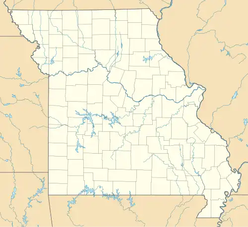
| Coordinates: 38°17′11″N 93°05′48″W / 38.28639°N 93.09667°W | |
| Country | United States |
| State | Missouri |
| County | Benton |
| Elevation | 666 ft (203 m) |
| Time zone | UTC-6 (Central (CST)) |
| • Summer (DST) | UTC-5 (CDT) |
| Area code | 660 |
| GNIS feature ID | 729834[1] |
Zora or Old Zora is an unincorporated community in eastern Benton County, Missouri, United States.[1] Zora is located on the Big Buffalo Creek arm of the Lake of the Ozarks, 15.8 miles (25.4 km) east-northeast of Warsaw.[2][3]
A post office called Zora was established in 1887, and remained in operation until 1931.[4] The etymology of the name Zora is uncertain.[5]
References
- ^ a b c U.S. Geological Survey Geographic Names Information System: Zora, Missouri
- ^ Benton County General Highway Map (PDF) (Map). Missouri Department of Transportation. 2005. Retrieved May 23, 2012.
- ^ Missouri Atlas & Gazetteer, DeLorme, 1998, First edition, p. 44, ISBN 0-89933-224-2
- ^ "Post Offices". Jim Forte Postal History. Retrieved September 1, 2016.
- ^ "Benton County Place Names, 1928-1945 (archived)". The State Historical Society of Missouri. Archived from the original on June 24, 2016. Retrieved September 3, 2016.
Municipalities and communities of Benton County, Missouri, United States | ||
|---|---|---|
| Cities | 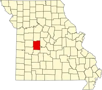 | |
| Village | ||
| Townships | ||
| CDPs | ||
| Unincorporated communities | ||
| Former settlements | ||
| Footnotes | ‡This populated place also has portions in an adjacent county or counties | |