Zambaulim
Zambaulim | |
|---|---|
village | |
 | |
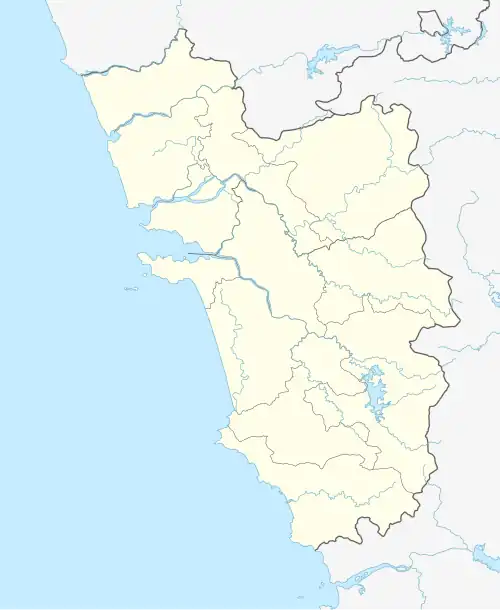 Zambaulim Location in Goa, India  Zambaulim Zambaulim (India) | |
| Coordinates: 15°11′0″N 74°6′0″E / 15.18333°N 74.10000°E | |
| Country | |
| State | Goa |
| District | South Goa |
| Elevation | 39 m (128 ft) |
| Languages | |
| • Official | Konkani |
| Time zone | UTC+5:30 (IST) |
| Vehicle registration | GA |
| Coastline | 0 kilometres (0 mi) |
| Website | goa |
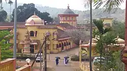
Zambaulim is a village in South Goa, Goa.
In the 1800s, it was the regional capital for the colonial Provincias de Zamboulim (also called Panchemal),[1] which was formed by merger of 5 surrounding districts of:
- Embarbacem,
- Chandrovadi,
- Balli,
- Astagrar,
- Cacora
Geography
It is located at an elevation of 39 m above MSL.[2]
Location
Nearest railway station is at Margao.
Places of interest
References
- ^ "Reclaiming the lost glory | the Navhind Times".
- ^ https://www.fallingrain.com/world/IN/33/Jambavali.html Map and weather of Zambaulim
External links