Westerbur
Westerbur | |
|---|---|
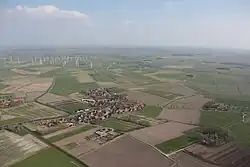 Aerial view of Westerbur | |
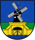 Coat of arms | |
Location of Westerbur | |
 Westerbur 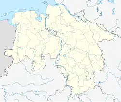 Westerbur | |
| Coordinates: 53°39′30″N 7°29′41″E / 53.65822°N 7.49461°E | |
| Country | Germany |
| State | Lower Saxony |
| District | Aurich |
| Municipality | Dornum |
| Area | |
| • Metro | 9.7 km2 (3.7 sq mi) |
| Elevation | 3 m (10 ft) |
| Population | |
| • Metro | 254[1] |
| Time zone | UTC+01:00 (CET) |
| • Summer (DST) | UTC+02:00 (CEST) |
| Dialling codes | 04933 |
| Vehicle registration | 26553 |
Westerbur is an East Frisian village in Lower Saxony, Germany. It is an Ortsteil of the municipality of Dornum, in the district of Aurich.[2] Administratively, the settlement of Middelsbur, located slightly to the northeast, belongs to Westerbur.
Geography
Westerbur is about one and a half kilometers south of the Wadden Sea coast. The main town of the municipality, Dornum, is about three kilometers away in a west-southwest direction. The neighboring village of Dornumersiel is two kilometers northwest.
History
The place was possibly first mentioned as Westerbure in the 8th/9th century. In 1530 the settlement was officially registered as Westerbuhr. The current spelling has been documented since 1589. The name was composed of its western direction and -bur and therefore means "western farming community".[3]
On 1 July 1972, Westerbur was incorporated into the municipality of Dornumersiel. On 1 November 2001, it became part of the municipality of Dornum.
Gallery
-
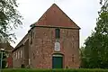
-
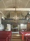 Interior of the church
References
- ^ "Wappen". Gemeinde Dornum (in German). Retrieved 21 October 2024.
- ^ Westerbur can be found at GEOnet Names Server, at this link, by opening the Advanced Search box, entering "-1886660" in the "Unique Feature Id" form, and clicking on "Search Database".
- ^ "Westerbur" (PDF). Ostfriesische Landschaft (in German). Retrieved 22 October 2024.
External links
![]() Media related to Westerbur at Wikimedia Commons
Media related to Westerbur at Wikimedia Commons
Villages in the municipality of Dornum | ||
|---|---|---|