Waitākere, New Zealand
Waitākere Township | |
|---|---|
 | |
| Coordinates: 36°51′00″S 174°32′35″E / 36.850°S 174.543°E | |
| Country | New Zealand |
| City | Auckland |
| Local authority | Auckland Council |
| Electoral ward | Waitākere ward |
| Local board | Waitākere Ranges Local Board |
| Area | |
| • Land | 1,479 ha (3,655 acres) |
| Population (June 2024)[2] | |
• Total | 1,890 |
| Train stations | Waitakere railway station |
| Waimauku | Taupaki | Massey |
| Muriwai |
|
Massey |
| Te Henga / Bethells Beach |
(Waitākere Ranges) | Swanson |
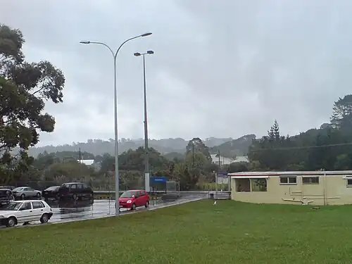
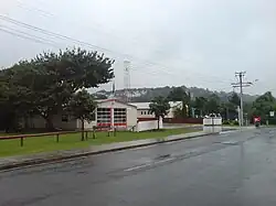
Waitākere, often called Waitākere Township or Waitākere Town,[3][4] is a small, mostly rural settlement to the northwest of Auckland, New Zealand.
History
The settlement is in the traditional rohe of Te Kawerau ā Maki.[5] The many hills of the area were known as Ngā Rau Pou ā Maki, referring to the eponymous ancestor of the tribe.[6]
During the latter 19th century, the King brothers established a flax mill at Waitākere.[7] In 1881, the Waitākere railway station was opened, when the North Auckland Line was extended from New Lynn to Helensville.[8][9]
Waitakere Road had two bridges constructed to bypass the now Township Road making it a dead-end or cul-de-sac.
Demographics
Waitākere covers 14.79 km2 (5.71 sq mi)[1] and had an estimated population of 1,890 as of June 2024,[2] with a population density of 128 people per km2.
| Year | Pop. | ±% p.a. |
|---|---|---|
| 2006 | 1,755 | — |
| 2013 | 1,674 | −0.67% |
| 2018 | 1,818 | +1.66% |
| 2023 | 1,812 | −0.07% |
| The 2006 population is for a larger area of 15.29 km2 Source: [10][11] | ||
Waitākere had a population of 1,812 in the 2023 New Zealand census, a decrease of 6 people (−0.3%) since the 2018 census, and an increase of 138 people (8.2%) since the 2013 census. There were 906 males, 900 females and 9 people of other genders in 612 dwellings.[12] 2.8% of people identified as LGBTIQ+. The median age was 41.7 years (compared with 38.1 years nationally). There were 360 people (19.9%) aged under 15 years, 282 (15.6%) aged 15 to 29, 933 (51.5%) aged 30 to 64, and 237 (13.1%) aged 65 or older.[11]
People could identify as more than one ethnicity. The results were 90.7% European (Pākehā); 14.6% Māori; 7.6% Pasifika; 5.5% Asian; 0.8% Middle Eastern, Latin American and African New Zealanders (MELAA); and 3.0% other, which includes people giving their ethnicity as "New Zealander". English was spoken by 98.0%, Māori language by 2.6%, Samoan by 0.5%, and other languages by 7.8%. No language could be spoken by 1.3% (e.g. too young to talk). New Zealand Sign Language was known by 0.2%. The percentage of people born overseas was 20.4, compared with 28.8% nationally.
Religious affiliations were 22.0% Christian, 1.0% Hindu, 0.7% Islam, 0.3% Māori religious beliefs, 0.2% Buddhist, 0.8% New Age, and 1.7% other religions. People who answered that they had no religion were 65.6%, and 7.6% of people did not answer the census question.
Of those at least 15 years old, 249 (17.1%) people had a bachelor's or higher degree, 798 (55.0%) had a post-high school certificate or diploma, and 306 (21.1%) people exclusively held high school qualifications. The median income was $51,100, compared with $41,500 nationally. 234 people (16.1%) earned over $100,000 compared to 12.1% nationally. The employment status of those at least 15 was that 861 (59.3%) people were employed full-time, 216 (14.9%) were part-time, and 33 (2.3%) were unemployed.[11]
Education
Waitakere School is a coeducational full primary (years 1–8) school with a roll of 432 students as at July 2025.[13][14] It was established in 1921.[15]
List of places within Waitakere township
- Waitakere RSA
- Waitakere Dairy & Postshop there was an armed robbery in 2017.[16]
- Waitakere railway station
- Waitakere Township Hall[17]
- Waitakere War Memorial Park
- Waitakere Fire Station
- Waitakere Kindergarten [18]
Notable people
- Arthur "Artie" Campbell Jonkers Artie was a well known figure on the family farm in Waitakere township where he worked tirelessly farming sheep. [19]
See also
References
- ^ a b "Stats NZ Geographic Data Service". Statistical Area 2 2023 (generalised). Retrieved 25 December 2024.
- ^ a b "Aotearoa Data Explorer". Statistics New Zealand. Retrieved 26 October 2024.
- ^ Waitakere Ranges Heritage Area (PDF) (Report). Auckland Council. 14 April 2011. Retrieved 17 June 2024.
- ^ "'There will be nails': Local's sinister threat in note left outside West Auckland primary school". The New Zealand Herald. 24 October 2019. Retrieved 17 June 2024.
- ^ Te Kawerau ā Maki; The Trustees of Te Kawerau Iwi Settlement Trust; The Crown (22 February 2014). "Te Kawerau ā Maki Deed of Settlement Schedule" (PDF). Retrieved 10 May 2022.
- ^ Diamond, John T.; Hayward, Bruce W. (1990). "Prehistoric Sites in West Auckland". In Northcote-Bade, James (ed.). West Auckland Remembers, Volume 1. West Auckland Historical Society. pp. 14, 18. ISBN 0-473-00983-8.
- ^ Dunsford, Deborah (2002). Doing It Themselves: the Story of Kumeu, Huapai and Taupaki. Huapai-Kumeu Lions Club. p. 50. ISBN 0-473-08969-6.
- ^ Scoble, Juliet (2010). "Names & Opening & Closing Dates of Railway Stations" (PDF). Rail Heritage Trust of New Zealand. Archived from the original (PDF) on 24 July 2020. Retrieved 12 October 2019.
- ^ Railway Stations of Auckland's Western Line (2004) by Sean Millar
- ^ "Statistical area 1 dataset for 2018 Census". Statistics New Zealand. March 2020. Waitakere (118000). 2018 Census place summary: Waitakere
- ^ a b c "Totals by topic for individuals, (RC, TALB, UR, SA3, SA2, Ward, Health), 2013, 2018, and 2023 Censuses". Stats NZ – Tatauranga Aotearoa – Aotearoa Data Explorer. Waitākere (118001). Retrieved 3 October 2024.
- ^ "Totals by topic for dwellings, (RC, TALB, UR, SA3, SA2, Ward, Health), 2013, 2018, and 2023 Censuses". Stats NZ – Tatauranga Aotearoa – Aotearoa Data Explorer. Retrieved 3 October 2024.
- ^ "New Zealand Schools Directory". New Zealand Ministry of Education. Retrieved 1 July 2025.
- ^ Education Counts: Waitakere School
- ^ "Waitakere School golden jubilee 1921-1971 (record)". National Museum of New Zealand. Retrieved 13 June 2022.
- ^ "Police backing dairy owners but robberies on the rise". stuff.co.nz. Stuff. 7 October 2017. Retrieved 30 June 2020.
- ^ Grevel, Louise. "Waitakere Township Hall". aucklandcouncil.govt.nz. Auckland Council. Retrieved 30 June 2020.
- ^ "Waitakere Kindergarten". ero.govt.nz. Education Review Office. 8 February 2018. Retrieved 30 June 2020.
- ^ Wigmore, Caryn (20 February 2014). "Old soldier a hard worker". stuff.co.nz. Stuff. Retrieved 30 June 2020.