Wadi Al Munay
| Wadi Al Munay Wādī Al Minе̄‘ī | |
|---|---|
 | |
   | |
| Native name | وادي المنيعي (Arabic) |
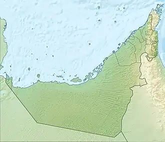
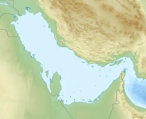
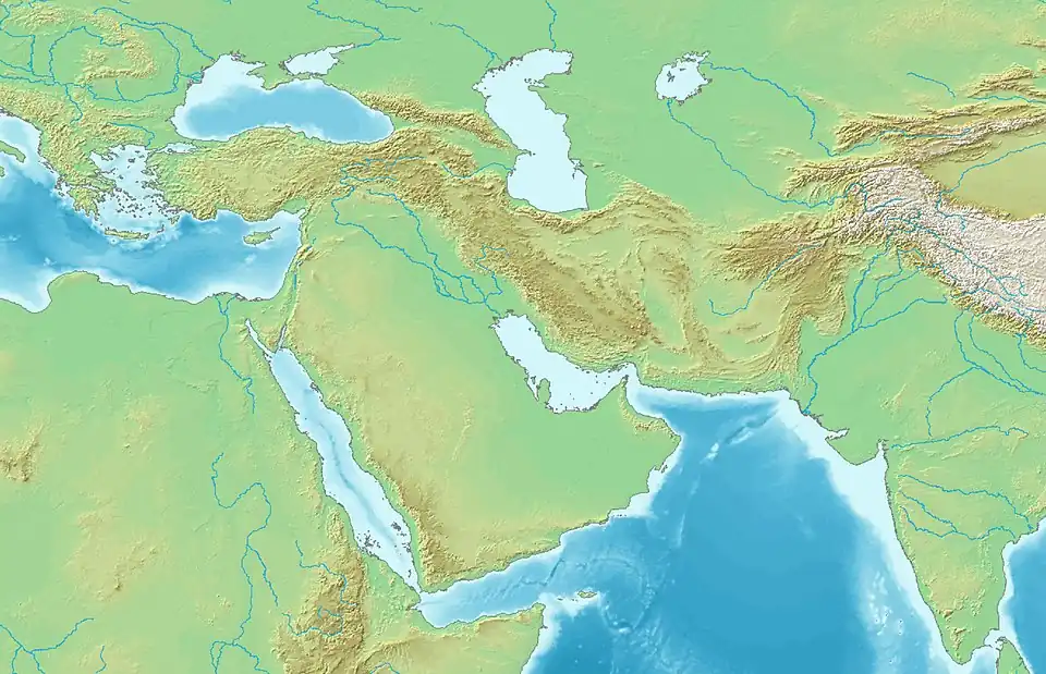
| Location | |
| Country | |
| Emirate | |
| Physical characteristics | |
| Source | At the northwestern end of the Wadi Al Qor watershed. |
| • elevation | 748 m (2,454 ft), approximately |
| Mouth | Confluence with the Wadi Al Qor at Bida' Majed, near the village of Al Fashqah.[1] |
• coordinates | 24°52′56″N 56°12′34″E / 24.88222°N 56.20944°E |
• elevation | 157 m (515 ft) |
| Length | 27 km (17 mi) |
| Basin size | 303 km2 (117 sq mi) (Wadi Al Qor basin).[2] |
| Basin features | |
| Progression | Wadi. Intermittent flow |
| River system | Wadi Al Qor |
| Tributaries | |
| • left | Wadi Bu Harman, Wadi Al Luss |
| • right | Wadi Tuwa, Wadi Al Rabka |
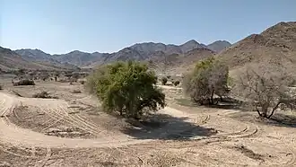
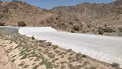
Wadi Al Munay (Arabic: وادي المنيعي), romanized: Wādī Al Minе̄‘ī) [3][4][5][6] is a valley or dry river, with ephemeral or intermittent flow, which flows almost exclusively during the rainy season, located in the emirate of Ras al Khaimah, in the east of the United Arab Emirates.
It is the main tributary of the Wadi Al Qor, to whose 303 km2 (117 sq mi) drainage basin it belongs.[2][7][8]
Course
The total approximate length of Wadi Al Munay is 27 km (17 mi). [9]
It flows from northwest to southeast, and its main source is located at an altitude of approximately 748 m (2,454 ft), at the northwestern end of the drainage divide of the Wadi Al Qor, on the eastern slope of the mountain ridge that marks the drainage divide between the basins that drain into the Gulf of Oman, and those that drain into the Persian Gulf and inland floodplains.[4][5]
For approximately 12 km (7.5 mi) (from the end of its upper course to past the village of Al Munay), the E102 Sharjah - Kalba Road closely follows the wadi's channel, crossing it at several points.
Wadi Al Munay has a steeper gradient and faster underground flow than Wadi Al Qor, but apart from its headwaters, which have a steep slope typical of mountain ravines, the middle and lower reaches of the wadi have a relatively moderate gradient.[1]
Along its course, Wadi Al Munay passes, among other towns and villages, Al Munay (Sha'biyyat Al Minē'ī), Al Waab (Arabic: شعبية الوعب, romanized: Sha'biyyat Al Wa'ab) and Sikhebar (Arabic: شعبية صخيبر), romanized: Sha'biyyat Sikhе̄bar),[10][11] flanked on both banks by a multitude of small, widely scattered farms and agricultural holdings.[3]
In the past, these villages had forts or watchtowers for protection and maintenance, and had a prosperous agricultural economy, based mainly on the cultivation and sale of tobacco, and the production of dates, mangoes, oranges, limes, and other fruits, as well as the cultivation of cereals.[12][13][14]
The Wadi Al Munay merges and flows into the Wadi Al Qor in the area of Bida' Majed, approximately one kilometer from the town of Al Fashqah / Fashrah.[1][15]
Dams and Reservoirs
Like most wadis in the United Arab Emirates and Oman, Wadi Al Munay is prone to severe flooding.[16][17]
To prevent the risk of flash floods and increase the recharge potential of groundwater, four small dams were built in 2002 on some of the tributaries of Wadi Al Munay: [18][19]
- On one branch or tributary, called Wadi Bu Harman in the National Atlas,[3] an 8.5 m (28 ft)-high dam was built, with a reservoir of 0.08 km2 (0.031 sq mi) and a capacity of 0.05 million cubic meters (coordinates: 24°59′45″N, 56°06′51″E). The dam is located a few meters before the confluence of this tributary with the main wadi, very close to the village of Al Munay,[3] and was named Al Munai Breaker.
- In Wadi Tuwa / Wadi Tawah, another dam of 8.4 m (28 ft) height was built, with a reservoir of 0.1584 km2 (0.0612 sq mi) and a capacity of 0.49 million cubic meters, called the Wadi Tuwa Dam (coordinates: 25°1′15″N, 56°7′34″E).
- In the Wadi Al Luss, a third dam, 8.7 m (29 ft) high, with a reservoir of 0.045 km2 (0.017 sq mi) and a capacity of 0.05 million cubic meters, called the Wadi Al Luss Dam (coordinates: 24°58′20″N, 56°07′44″E).
- And finally, in the Wadi Al Rabka, another 8.8 m (29 ft) high, with a reservoir of 0.182 km2 (0.070 sq mi) and a capacity of 0.542 million cubic meters, called Wadi Al Rabka Dam (coordinates: 24°57′43″N, 56°09′57″E).
Toponymy
Alternative names: Wadi Munay`i, Wādī Munay‘ī, Wadi Munai, Wadi Manai, Wādī Al Minе̄‘ī, Wadi Al Munai, Wadi Munay, Wādī al-Munaīʿī, Wadi al-Munai'i, Al Munai'e.
The name of Wadi Al Munay (spelled Wādī Munay‘ī), its tributaries, mountains and nearby towns was recorded in the documentation and maps produced between 1950 and 1960 by the British Arabist, cartographer, military officer and diplomat Julian F. Walker, during the work carried out to establish the borders between the then so-called Trucial States.[20] This work was later completed by the Ministry of Defence of the United Kingdom, with 1:100,000 scale maps published in 1971.[4][5]
In the National Atlas of the United Arab Emirates it appears as Wādī Al Minе̄‘ī (Arabic: وادي المنيعي).[3]
Population
The entire area around Wadi Al Munay was occupied mainly by the Dahaminah tribal area,[10][21][22] as well as Bani Kaab, [23][24] Maharzah,[12] and Quwayd / Quwayyid.[12][25]
See also
- List of wadis of the United Arab Emirates
- List of mountains in the United Arab Emirates
- List of wadis of Oman
- List of mountains in Oman
References
- ^ a b c Uqba, Khaled Ali (1991). The water resources of the United Arab Emirates: a comprehensive empirical appraisal of their status and management (Doctoral thesis). Durham University.
- ^ a b Water Resources and Integrated Management of the United Arab Emirates - Abdulrahman S. Alsharhan, Zeinelabidin E. Rizk - Springer Nature, Mar 17, 2020 - 850 pages - pag. 204-205 <https://books.google.com/books?id=lF7XDwAAQBAJ&pg=PA103&hl=es&source=gbs_selected_pages&cad=1#v=onepage&q&f=false>
- ^ a b c d e Jāmiʿat al-Imārāt al-ʿArabīyah al-Muttaḥidah (1993). The national atlas of the United Arab Emirates. Al Ain, United Arab Emirates: United Arab Emirates University with GEOprojects (U.K.) Ltd. ISBN 9780863511004.
- ^ a b c Trucial States, Muscat and Oman: Aswad - Scale 1:100 000 - Published by D Survey, Ministry of Defence, United Kingdom (1971) - Edition 3-GSGS - The National Archives, London, England <https://www.agda.ae/en/catalogue/tna/fco/18/1796/n/1>
- ^ a b c "FCO 18/1792 1970 Map of Trucial States: Muscat and Oman: Masafi". www.agda.ae. United Arab Emirates: Arabian Gulf Digital Archives. 1971. Retrieved 15 May 2025.
- ^ Mindat.org - Wādī Munay‘ī, Ra’s al Khaymah, United Arab Emirates <https://www.mindat.org/feature-389982.html>
- ^ OpenStreetMap.org - Way: Wadi Al Qor Drainage Basin (1319415880) <https://www.openstreetmap.org/way/1319415880#map=11/24.9232/56.2253&layers=P>
- ^ Application of a hydrological model in a data poor arid region catchment: a case study of Wadi Ham - Mohamed Mustafa Al Mulla PhD Thesis Academic Year 2005-2006 - Supervisor: Dr Ian P. Holman - December 1, 2005 - Cranfield University at Silsoe - Institute of Water and Environment <https://dspace.lib.cranfield.ac.uk/items/c116d8d5-f80b-4c8b-b754-7507d3abec27>
- ^ OpenStreetMap.org - Way: Wadi Al Munay (654795181) <https://www.openstreetmap.org/way/654795181#map=12/24.9669/56.1479&layers=P>
- ^ a b Lancaster, W. and Lancaster, F. (2010), Pottery makers and pottery users: in Ras al-Khaimah emirate and Musandam wilayat of Oman, and around Ra’s al-Junayz in the south-east of Ja’alan wilayat, Oman. Arabian Archaeology and Epigraphy, 21: 199-255. https://doi.org/10.1111/j.1600-0471.2010.00331.x
- ^ WAM (2008-01-18). "A tour of generosity and concern". GulfNews. Retrieved 2018-05-22.
- ^ a b c Lancaster, William, 1938- (2011). Honour is in contentment : life before oil in Ras al-Khaimah (UAE) and some neighboring regions. Lancaster, Fidelity. Berlin: De Gruyter. ISBN 978-3-11-022340-8. OCLC 763160662.
{{cite book}}: CS1 maint: multiple names: authors list (link) CS1 maint: numeric names: authors list (link) - ^ "Al-Munaie weaves history with threads of generosity. It has a stable climate throughout the year - 02-12-2015 المنيعي تغزل التاريخ بخيوط الكرم". www.albayan.ae (in Arabic). Retrieved 2025-05-05.
- ^ "Al-Munaie...a mountain fortress for its people against time and hardship - 12-10-2005 المنيعي .. حصن جبلي لأهله ضد الزمن والمحن". www.alkhaleej.ae (in Arabic). Retrieved 2025-05-05.
- ^ "Fashrah GNS:id -782874". National Geospatial-Intelligence Agency (NGA). Retrieved 2025-05-22.
- ^ "The flow of Wadi Al-Munai and Al-Huwailat - 29-10-2018 جريان وادي المنيعي والحويلات". www.aletihad.ae (in Arabic). Retrieved 2025-05-22.
- ^ "Police warn against approaching valleys and waterways. Rain and hail are expected in Ras Al Khaimah and Fujairahn - 9-10-2011 الشرطة تحذر من الاقتراب من الوديان ومجــــاري المياه أمطار وبرد علـى رأس الخيمة والفجيرة". www.emaratalyoum.com (in Arabic). Retrieved 2025-05-05.
- ^ FAO's Global Information System on Water and Agriculture - Food and Agriculture Organization of the United Nations AQUASTAT <https://www.fao.org/aquastat/en/databases/dams>
- ^ Ministry of Energy and Infrastructure in UAE - Federal Dams https://admin.bayanat.ae/Home/DatasetInfo?dID=lFWr8jmvtTwdCtQd7uDtLjOq-EB6rfmemu-OtkcDuCo&langKey=en>
- ^ FCO 18/1937 1958 Sketch map drawn by Julian Walker for boundary delimitation: Dhaid-Masafi - The National Archives, London, England <https://www.agda.ae/en/catalogue/tna/fco/18/1937>
- ^ FO 371/149153 - 1958 Tribes of Trucial States coast - The National Archives, London, England <https://www.agda.ae/en/catalogue/tna/fo/371/114648/n/133>
- ^ Mindat.org - Dahāminah, Ra’s al Khaymah, United Arab Emirates <https://www.mindat.org/feature-292297.html>
- ^ Heard-Bey, Frauke (2005). From Trucial States to United Arab Emirates : a society in transition. London: Motivate. p. 435. ISBN 1860631673. OCLC 64689681.
- ^ Gazetteer of the Persian Gulf. Vol. II. Geographical and Statistical. J G Lorimer. 1908', British Library: India Office Records and Private Papers, IOR/L/PS/20/C91/4 p. 1560, in Qatar Digital Library <https://www.qdl.qa/en/archive/81055/vdc_100023515719.0x00004e>
- ^ Mindat.org - Quwayd, Ra’s al Khaymah, United Arab Emirates<https://www.mindat.org/feature-291115.html>
External links
![]() Media related to Wadi Al Munay at Wikimedia Commons
Media related to Wadi Al Munay at Wikimedia Commons