Val de Louyre et Caudeau
Val de Louyre et Caudeau | |
|---|---|
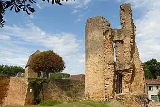 Lostanges castle ruins in Sainte-Alvère | |
Location of Val de Louyre et Caudeau | |
 Val de Louyre et Caudeau  Val de Louyre et Caudeau | |
| Coordinates: 44°56′49″N 0°48′32″E / 44.947°N 0.809°E | |
| Country | France |
| Region | Nouvelle-Aquitaine |
| Department | Dordogne |
| Arrondissement | Périgueux |
| Canton | Périgord central |
| Intercommunality | Le Grand Périgueux |
Area 1 | 82.12 km2 (31.71 sq mi) |
| Population (2022)[1] | 1,592 |
| • Density | 19/km2 (50/sq mi) |
| Time zone | UTC+01:00 (CET) |
| • Summer (DST) | UTC+02:00 (CEST) |
| INSEE/Postal code | 24362 /24510 |
| 1 French Land Register data, which excludes lakes, ponds, glaciers > 1 km2 (0.386 sq mi or 247 acres) and river estuaries. | |
Val de Louyre et Caudeau (Occitan: Vallée de Louyre e Caudeau) is a commune in the department of Dordogne, southwestern France. It was established on 1 January 2017 by the merger of the former communes of Cendrieux and Sainte-Alvère-Saint-Laurent Les Bâtons.[2] Sainte-Alvère-Saint-Laurent Les Bâtons was the result of the merger of the communes of Sainte-Alvère and Saint-Laurent-des-Bâtons on 1 January 2016.[3]
In 2021, the comune had 1,590 inhabitants.
The most important towns located in the commune are Cendrieux, Saint-Laurent-des-Bâtons and Sainte-Alvère. There are also several other small villages and hamlets.
See also
References
Wikimedia Commons has media related to Val de Louyre et Caudeau.
- ^ "Populations de référence 2022" (in French). The National Institute of Statistics and Economic Studies. 19 December 2024.
- ^ Arrêté préfectoral 26 September 2016 (in French)
- ^ Arrêté préfectoral 22 October 2015, page 28. (in French)